
Riederhof Rennradtrainingstour 2
A cycling route starting in Ried im Oberinntal, Tyrol, Austria.
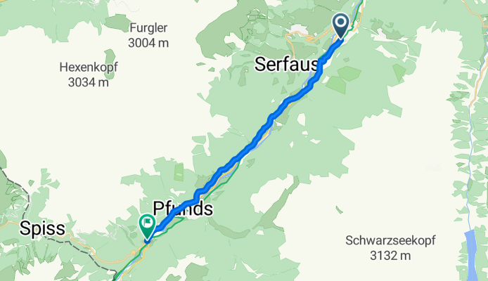
Overview
About this route
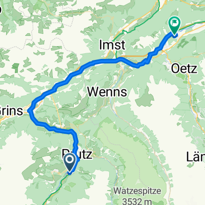
From the hotel via Tösens, Lafairsch, Pfunds to the Swiss border (Schalkle) and back. Route of 32.20 km round trip
- -:--
- Duration
- 16.1 km
- Distance
- 275 m
- Ascent
- 179 m
- Descent
- ---
- Avg. speed
- 994 m
- Max. altitude
Route quality
Waytypes & surfaces along the route
Waytypes
Quiet road
1.4 km
(9 %)
Access road
0.2 km
(1 %)
Undefined
14.5 km
(90 %)
Surfaces
Paved
15.6 km
(97 %)
Asphalt
15.6 km
(97 %)
Undefined
0.5 km
(3 %)
Continue with Bikemap
Use, edit, or download this cycling route
You would like to ride Riederhof Rennradtrainingstour 2 or customize it for your own trip? Here is what you can do with this Bikemap route:
Free features
- Save this route as favorite or in collections
- Copy & plan your own version of this route
- Sync your route with Garmin or Wahoo
Premium features
Free trial for 3 days, or one-time payment. More about Bikemap Premium.
- Navigate this route on iOS & Android
- Export a GPX / KML file of this route
- Create your custom printout (try it for free)
- Download this route for offline navigation
Discover more Premium features.
Get Bikemap PremiumFrom our community
Other popular routes starting in Ried im Oberinntal
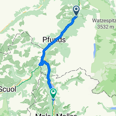 Serfaus - Schlanders
- Distance
- 48.5 km
- Ascent
- 1,720 m
- Descent
- 1,144 m
- Location
- Ried im Oberinntal, Tyrol, Austria
 Ried-Pfunds-Martina-Reschenpass-Burgeis-Laas
- Distance
- 78.7 km
- Ascent
- 1,165 m
- Descent
- 1,154 m
- Location
- Ried im Oberinntal, Tyrol, Austria
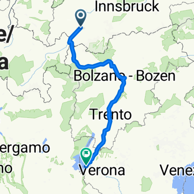 Ried - Gardasee ( Lazise)
- Distance
- 294.9 km
- Ascent
- 849 m
- Descent
- 1,662 m
- Location
- Ried im Oberinntal, Tyrol, Austria
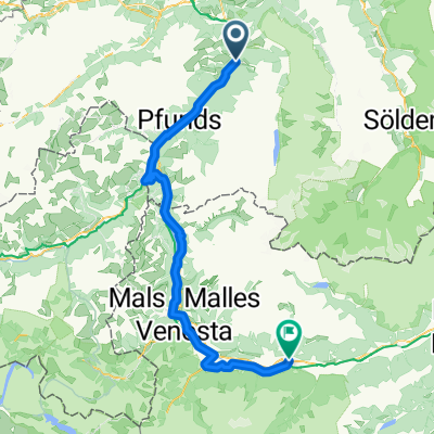 Fl04b Ried - Schlanders
- Distance
- 88.7 km
- Ascent
- 1,204 m
- Descent
- 1,348 m
- Location
- Ried im Oberinntal, Tyrol, Austria
 Motitz4
- Distance
- 68.5 km
- Ascent
- 1,195 m
- Descent
- 823 m
- Location
- Ried im Oberinntal, Tyrol, Austria
 Ried im Oberinntal nach Haiming (Innradweg)
- Distance
- 51.7 km
- Ascent
- 1,094 m
- Descent
- 1,299 m
- Location
- Ried im Oberinntal, Tyrol, Austria
 Alpencross Roadbike - Stage 2 - Ried Oberinntal>>Trafoi
- Distance
- 80.9 km
- Ascent
- 1,382 m
- Descent
- 739 m
- Location
- Ried im Oberinntal, Tyrol, Austria
 Kaunertal
- Distance
- 47.8 km
- Ascent
- 1,068 m
- Descent
- 1,058 m
- Location
- Ried im Oberinntal, Tyrol, Austria
Open it in the app