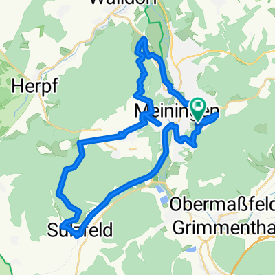
Meiningen/Werra nach Bad Kissingen/Rhön CLONED FROM ROUTE 1904
A cycling route starting in Meiningen, Thuringia, Germany.
Overview
About this route
10th stage from Hamburg to Munich. From the Werra to the Franconian Saale. A fantastic route, but quite demanding when carrying luggage. Bad Kissingen is worth rewarding yourself with a rest stop on a long-distance ride. The old town and spa facilities are simply amazing. Accommodation is plentiful in all price ranges, also for just one or two nights.
- -:--
- Duration
- 68.2 km
- Distance
- 312 m
- Ascent
- 397 m
- Descent
- ---
- Avg. speed
- ---
- Max. altitude
Continue with Bikemap
Use, edit, or download this cycling route
You would like to ride Meiningen/Werra nach Bad Kissingen/Rhön CLONED FROM ROUTE 1904 or customize it for your own trip? Here is what you can do with this Bikemap route:
Free features
- Save this route as favorite or in collections
- Copy & plan your own version of this route
- Sync your route with Garmin or Wahoo
Premium features
Free trial for 3 days, or one-time payment. More about Bikemap Premium.
- Navigate this route on iOS & Android
- Export a GPX / KML file of this route
- Create your custom printout (try it for free)
- Download this route for offline navigation
Discover more Premium features.
Get Bikemap PremiumFrom our community
Other popular routes starting in Meiningen
 MGN-Hohe Mass-Helehenhöe-MGN
- Distance
- 15.7 km
- Ascent
- 274 m
- Descent
- 275 m
- Location
- Meiningen, Thuringia, Germany
 Werra 2009
- Distance
- 228.4 km
- Ascent
- 982 m
- Descent
- 1,118 m
- Location
- Meiningen, Thuringia, Germany
 Am Wandervogel 37, Meiningen nach Am Wandervogel 37, Meiningen
- Distance
- 31.4 km
- Ascent
- 491 m
- Descent
- 491 m
- Location
- Meiningen, Thuringia, Germany
 Gruenes Band 23
- Distance
- 238.3 km
- Ascent
- 2,989 m
- Descent
- 2,799 m
- Location
- Meiningen, Thuringia, Germany
 2025-05-09_Meinigen-Werra-Obersuhl
- Distance
- 85.6 km
- Ascent
- 503 m
- Descent
- 577 m
- Location
- Meiningen, Thuringia, Germany
 MGN - Dreißigacker - Sülzfeld - Fasanerie - MGN
- Distance
- 29.7 km
- Ascent
- 331 m
- Descent
- 338 m
- Location
- Meiningen, Thuringia, Germany
 067 Zipfeltour2013 Tag07 Meiningen-Ruhla
- Distance
- 57.9 km
- Ascent
- 504 m
- Descent
- 466 m
- Location
- Meiningen, Thuringia, Germany
 Rundfahrt mit Eike
- Distance
- 35.1 km
- Ascent
- 374 m
- Descent
- 388 m
- Location
- Meiningen, Thuringia, Germany
Open it in the app

