RĂ€vlandarundan
A cycling route starting in HindÄs, VÀstra Götaland County, Sweden.
Overview
About this route
Kort, men bra runda med höjdskillnader och l-Ä-n-g-a backar som kÀnns bra i benen...
- -:--
- Duration
- 22.8 km
- Distance
- 211 m
- Ascent
- 206 m
- Descent
- ---
- Avg. speed
- 162 m
- Max. altitude
Route quality
Waytypes & surfaces along the route
Waytypes
Road
17.3 km
(76 %)
Quiet road
2.9 km
(13 %)
Surfaces
Paved
16 km
(70 %)
Asphalt
16 km
(70 %)
Undefined
6.8 km
(30 %)
Continue with Bikemap
Use, edit, or download this cycling route
You would like to ride RĂ€vlandarundan or customize it for your own trip? Here is what you can do with this Bikemap route:
Free features
- Save this route as favorite or in collections
- Copy & plan your own version of this route
- Sync your route with Garmin or Wahoo
Premium features
Free trial for 3 days, or one-time payment. More about Bikemap Premium.
- Navigate this route on iOS & Android
- Export a GPX / KML file of this route
- Create your custom printout (try it for free)
- Download this route for offline navigation
Discover more Premium features.
Get Bikemap PremiumFrom our community
Other popular routes starting in HindÄs
- HindĂ„s-Bollebygd-Töllsjö-ĂdenĂ€s
- Distance
- 58 km
- Ascent
- 585 m
- Descent
- 585 m
- Location
- HindÄs, VÀstra Götaland County, Sweden
- StorÄns dalgÄng aug 2023
- Distance
- 34.2 km
- Ascent
- 254 m
- Descent
- 253 m
- Location
- HindÄs, VÀstra Götaland County, Sweden
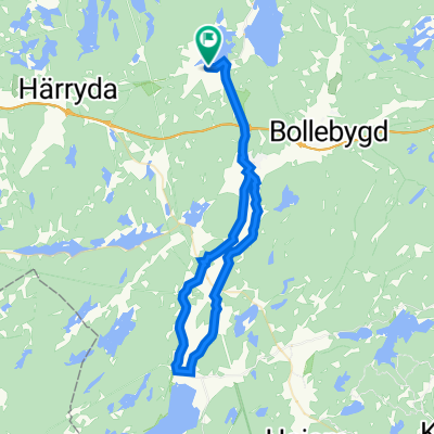
- 57.709° N 12.454° W to 57.710° N 12.481° W
- Distance
- 19.3 km
- Ascent
- 227 m
- Descent
- 201 m
- Location
- HindÄs, VÀstra Götaland County, Sweden
- HindĂ„s-Lerum-EdsĂ„s-ĂdenĂ€s
- Distance
- 61.8 km
- Ascent
- 538 m
- Descent
- 541 m
- Location
- HindÄs, VÀstra Götaland County, Sweden
- VĂ€gskillnaden 200 to Piazza del Colosseo 4470, Roma
- Distance
- 2,464 km
- Ascent
- 22,244 m
- Descent
- 22,352 m
- Location
- HindÄs, VÀstra Götaland County, Sweden
- HindÄs-RÀvlanda-SÀtila
- Distance
- 45.6 km
- Ascent
- 384 m
- Descent
- 385 m
- Location
- HindÄs, VÀstra Götaland County, Sweden
- Recovered Route
- Distance
- 35 km
- Ascent
- 291 m
- Descent
- 284 m
- Location
- HindÄs, VÀstra Götaland County, Sweden
- HindÄs-Eskilsbyn-HÀllingsjö
- Distance
- 45.3 km
- Ascent
- 415 m
- Descent
- 417 m
- Location
- HindÄs, VÀstra Götaland County, Sweden
Open it in the app