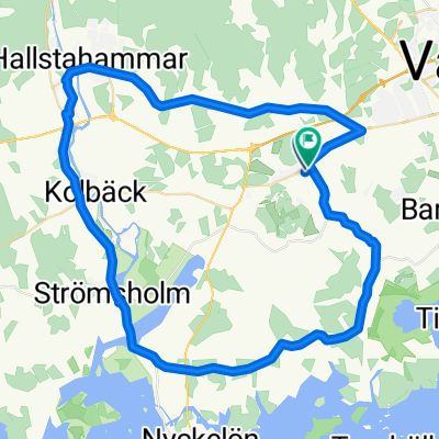
Strömsholm-Dufweholm
A cycling route starting in KolbÀck, VÀstmanland County, Sweden.
Overview
About this route
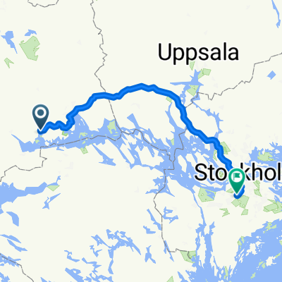
Day 2 of the tandem bike trek from Uppsala to HindÄs in July 2007, the previous day went from Uppsala to Strömsholm, and the next day from Dufweholm to Borensberg.
Â
The roads from Eskilstuna to Katrineholm were dominantly pretty boring, and the least interesting part of the entire trek: planted uniform Swedish conifer forest and not much else. Dufweholms herrgÄrd is an excellent place to stay; not cheap, but very good.
- -:--
- Duration
- 95.7 km
- Distance
- 474 m
- Ascent
- 433 m
- Descent
- ---
- Avg. speed
- 89 m
- Avg. speed
Route quality
Waytypes & surfaces along the route
Waytypes
Road
46.7 km
(49 %)
Quiet road
22.9 km
(24 %)
Surfaces
Paved
83.3 km
(87 %)
Unpaved
10.9 km
(11 %)
Asphalt
83.3 km
(87 %)
Unpaved (undefined)
5.7 km
(6 %)
Continue with Bikemap
Use, edit, or download this cycling route
You would like to ride Strömsholm-Dufweholm or customize it for your own trip? Here is what you can do with this Bikemap route:
Free features
- Save this route as favorite or in collections
- Copy & plan your own version of this route
- Split it into stages to create a multi-day tour
- Sync your route with Garmin or Wahoo
Premium features
Free trial for 3 days, or one-time payment. More about Bikemap Premium.
- Navigate this route on iOS & Android
- Export a GPX / KML file of this route
- Create your custom printout (try it for free)
- Download this route for offline navigation
Discover more Premium features.
Get Bikemap PremiumFrom our community
Other popular routes starting in KolbÀck
- Stromsholm - Balsta
- Distance
- 112.1 km
- Ascent
- 239 m
- Descent
- 235 m
- Location
- KolbÀck, VÀstmanland County, Sweden
- Tingshusgatan 21 to Tingshusgatan 21
- Distance
- 75.4 km
- Ascent
- 413 m
- Descent
- 416 m
- Location
- KolbÀck, VÀstmanland County, Sweden
- Stationsgatan 12A, KolbÀck nach Hökartorget 2, Köping
- Distance
- 15.8 km
- Ascent
- 73 m
- Descent
- 74 m
- Location
- KolbÀck, VÀstmanland County, Sweden
- UTNĂS 11 to ValskogsvĂ€gen 70
- Distance
- 29.9 km
- Ascent
- 139 m
- Descent
- 139 m
- Location
- KolbÀck, VÀstmanland County, Sweden
- Strömsholm-Dufweholm
- Distance
- 95.7 km
- Ascent
- 474 m
- Descent
- 433 m
- Location
- KolbÀck, VÀstmanland County, Sweden
- EriksbergsvĂ€gen 7â9, Hallstahammar to VĂ€sttunagatan 7, Hallstahammar
- Distance
- 4.1 km
- Ascent
- 16 m
- Descent
- 0 m
- Location
- KolbÀck, VÀstmanland County, Sweden
- OskarsborgsvÀgen 37, Strömsholm to OskarsborgsvÀgen 37, Strömsholm
- Distance
- 11.9 km
- Ascent
- 135 m
- Descent
- 133 m
- Location
- KolbÀck, VÀstmanland County, Sweden
- Saköregatan to EkebyvÀgen
- Distance
- 2.1 km
- Ascent
- 14 m
- Descent
- 34 m
- Location
- KolbÀck, VÀstmanland County, Sweden
Open it in the app