

Plan trasy po DPNie
A cycling route starting in Gmina Kalisz Pomorski, West Pomeranian Voivodeship, Poland.
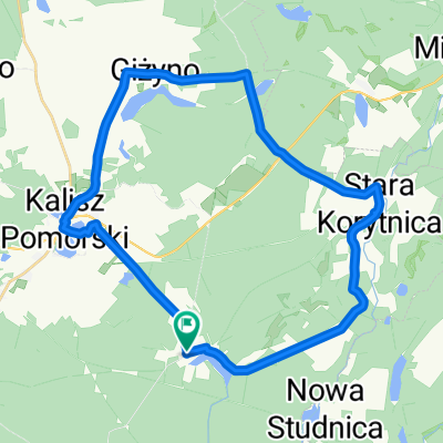
Overview
About this route
- -:--
- Duration
- 95 km
- Distance
- 288 m
- Ascent
- 286 m
- Descent
- ---
- Avg. speed
- ---
- Max. altitude

Route quality
Waytypes & surfaces along the route
Waytypes
Track
47.5 km
(50 %)
Quiet road
27.5 km
(29 %)
Surfaces
Paved
26.6 km
(28 %)
Unpaved
42.7 km
(45 %)
Asphalt
21.8 km
(23 %)
Ground
21.8 km
(23 %)
Route highlights
Points of interest along the route
Point of interest after 0 km
pole namiotowe camping mąkowary
Point of interest after 23.8 km
biwak Bogdanka
Point of interest after 44.6 km
ponoć miejsce biwakowe
Point of interest after 44.6 km
biwak/parking/fastfood Meta na Drawie
Point of interest after 46.3 km
biwak Kamienna
Point of interest after 51.2 km
biwak Pstrąg
Point of interest after 56.1 km
biwak Sitnica
Point of interest after 73.1 km
biwak Barnimie
Point of interest after 83.3 km
stanica PTTK
Continue with Bikemap
Use, edit, or download this cycling route
You would like to ride Plan trasy po DPNie or customize it for your own trip? Here is what you can do with this Bikemap route:
Free features
- Save this route as favorite or in collections
- Copy & plan your own version of this route
- Split it into stages to create a multi-day tour
- Sync your route with Garmin or Wahoo
Premium features
Free trial for 3 days, or one-time payment. More about Bikemap Premium.
- Navigate this route on iOS & Android
- Export a GPX / KML file of this route
- Create your custom printout (try it for free)
- Download this route for offline navigation
Discover more Premium features.
Get Bikemap PremiumFrom our community
Other popular routes starting in Gmina Kalisz Pomorski
 tour de drawsko - etap I
- Distance
- 84.6 km
- Ascent
- 247 m
- Descent
- 248 m
- Location
- Gmina Kalisz Pomorski, West Pomeranian Voivodeship, Poland
 Kalisz - Wałcz
- Distance
- 66.3 km
- Ascent
- 278 m
- Descent
- 264 m
- Location
- Gmina Kalisz Pomorski, West Pomeranian Voivodeship, Poland
 Stara Drawa 7 sierpnia 2017 r. kajakiem
- Distance
- 16.7 km
- Ascent
- 126 m
- Descent
- 133 m
- Location
- Gmina Kalisz Pomorski, West Pomeranian Voivodeship, Poland
 Biały Zdrój do Biały Zdrój
- Distance
- 29.7 km
- Ascent
- 230 m
- Descent
- 228 m
- Location
- Gmina Kalisz Pomorski, West Pomeranian Voivodeship, Poland
 Cybowo, Kalisz Pomorski do Trzebiń 4B, Recz
- Distance
- 35.1 km
- Ascent
- 214 m
- Descent
- 272 m
- Location
- Gmina Kalisz Pomorski, West Pomeranian Voivodeship, Poland
 Suchowo, Kalisz Pomorski do Suchowo 36, Kalisz Pomorski
- Distance
- 10.7 km
- Ascent
- 83 m
- Descent
- 86 m
- Location
- Gmina Kalisz Pomorski, West Pomeranian Voivodeship, Poland
 Kalisz Zatom
- Distance
- 66.1 km
- Ascent
- 186 m
- Descent
- 198 m
- Location
- Gmina Kalisz Pomorski, West Pomeranian Voivodeship, Poland
 Prostynia - Krzyz
- Distance
- 74.6 km
- Ascent
- 177 m
- Descent
- 227 m
- Location
- Gmina Kalisz Pomorski, West Pomeranian Voivodeship, Poland
Open it in the app