

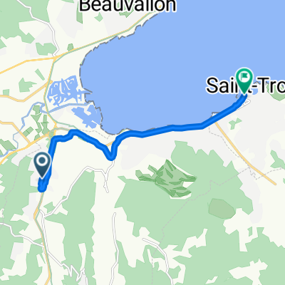
Cogolin-Le Plan de la Tour-La Garde Freinet-Grimaud
A cycling route starting in Gassin, Provence-Alpes-Côte d'Azur Region, France.
Overview
About this route
At the start and especially in the middle, quite a few climbs, 40 km.
- -:--
- Duration
- 39.9 km
- Distance
- 585 m
- Ascent
- 585 m
- Descent
- ---
- Avg. speed
- ---
- Max. altitude

Route quality
Waytypes & surfaces along the route
Waytypes
Road
6.8 km
(17 %)
Quiet road
4.8 km
(12 %)
Surfaces
Paved
38.3 km
(96 %)
Unpaved
0.4 km
(1 %)
Asphalt
38.3 km
(96 %)
Ground
0.4 km
(1 %)
Undefined
1.2 km
(3 %)
Continue with Bikemap
Use, edit, or download this cycling route
You would like to ride Cogolin-Le Plan de la Tour-La Garde Freinet-Grimaud or customize it for your own trip? Here is what you can do with this Bikemap route:
Free features
- Save this route as favorite or in collections
- Copy & plan your own version of this route
- Sync your route with Garmin or Wahoo
Premium features
Free trial for 3 days, or one-time payment. More about Bikemap Premium.
- Navigate this route on iOS & Android
- Export a GPX / KML file of this route
- Create your custom printout (try it for free)
- Download this route for offline navigation
Discover more Premium features.
Get Bikemap PremiumFrom our community
Other popular routes starting in Gassin
 210 Résidence les Deux Voiles, Cogolin naar 210 Résidence les Deux Voiles, Cogolin
- Distance
- 5.5 km
- Ascent
- 0 m
- Descent
- 0 m
- Location
- Gassin, Provence-Alpes-Côte d'Azur Region, France
 rayol gassin
- Distance
- 18.8 km
- Ascent
- 184 m
- Descent
- 321 m
- Location
- Gassin, Provence-Alpes-Côte d'Azur Region, France
 Moderate route in Grimaud
- Distance
- 2.4 km
- Ascent
- 0 m
- Descent
- 0 m
- Location
- Gassin, Provence-Alpes-Côte d'Azur Region, France
 210 Résidence les Deux Voiles, Cogolin naar 818–950 Boulevard de Gigaro, La Croix-Valmer
- Distance
- 13 km
- Ascent
- 190 m
- Descent
- 187 m
- Location
- Gassin, Provence-Alpes-Côte d'Azur Region, France
 Port Grimaud nach Toison d’or
- Distance
- 8.6 km
- Ascent
- 0 m
- Descent
- 4 m
- Location
- Gassin, Provence-Alpes-Côte d'Azur Region, France
 Recovered Route
- Distance
- 163.2 km
- Ascent
- 0 m
- Descent
- 20 m
- Location
- Gassin, Provence-Alpes-Côte d'Azur Region, France
 Gassin - Ramatuelle
- Distance
- 18.9 km
- Ascent
- 281 m
- Descent
- 281 m
- Location
- Gassin, Provence-Alpes-Côte d'Azur Region, France
 Cogolin-Le Plan de la Tour-La Garde Freinet-Grimaud
- Distance
- 39.9 km
- Ascent
- 585 m
- Descent
- 585 m
- Location
- Gassin, Provence-Alpes-Côte d'Azur Region, France
Open it in the app