

Luzny-Mohlsdorf
A cycling route starting in Perštejn, Ústecký kraj, Czechia.
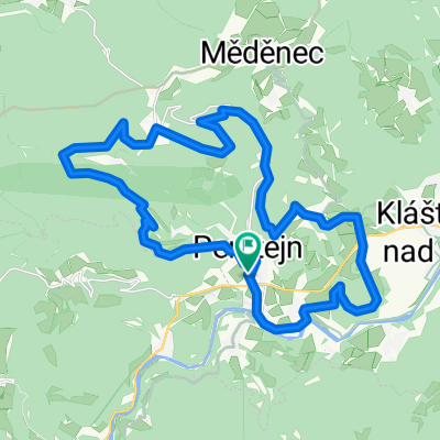
Overview
About this route
From the Eger home via the Keilber and the Erzgebirge ridge.
- -:--
- Duration
- 122.2 km
- Distance
- 1,320 m
- Ascent
- 1,284 m
- Descent
- ---
- Avg. speed
- ---
- Max. altitude
Route photos


Route quality
Waytypes & surfaces along the route
Waytypes
Road
51.3 km
(42 %)
Track
17.1 km
(14 %)
Surfaces
Paved
78.2 km
(64 %)
Unpaved
7.3 km
(6 %)
Asphalt
75.7 km
(62 %)
Gravel
6.1 km
(5 %)
Continue with Bikemap
Use, edit, or download this cycling route
You would like to ride Luzny-Mohlsdorf or customize it for your own trip? Here is what you can do with this Bikemap route:
Free features
- Save this route as favorite or in collections
- Copy & plan your own version of this route
- Split it into stages to create a multi-day tour
- Sync your route with Garmin or Wahoo
Premium features
Free trial for 3 days, or one-time payment. More about Bikemap Premium.
- Navigate this route on iOS & Android
- Export a GPX / KML file of this route
- Create your custom printout (try it for free)
- Download this route for offline navigation
Discover more Premium features.
Get Bikemap PremiumFrom our community
Other popular routes starting in Perštejn
 DOVRCHU - T1 - Klínovec
- Distance
- 16.9 km
- Ascent
- 959 m
- Descent
- 42 m
- Location
- Perštejn, Ústecký kraj, Czechia
 Giro 2012 fitness
- Distance
- 12.8 km
- Ascent
- 278 m
- Descent
- 278 m
- Location
- Perštejn, Ústecký kraj, Czechia
 Giro 2013
- Distance
- 40.4 km
- Ascent
- 900 m
- Descent
- 902 m
- Location
- Perštejn, Ústecký kraj, Czechia
 ILLEGAL ULTIMATE XCDOWN
- Distance
- 6.2 km
- Ascent
- 32 m
- Descent
- 496 m
- Location
- Perštejn, Ústecký kraj, Czechia
 Bikolka 2016 - den druhý
- Distance
- 64.6 km
- Ascent
- 795 m
- Descent
- 524 m
- Location
- Perštejn, Ústecký kraj, Czechia
 Perštejnské Giro 2010
- Distance
- 28.2 km
- Ascent
- 864 m
- Descent
- 859 m
- Location
- Perštejn, Ústecký kraj, Czechia
 Doupov
- Distance
- 47.7 km
- Ascent
- 640 m
- Descent
- 640 m
- Location
- Perštejn, Ústecký kraj, Czechia
 Perštejnské Giro 2010
- Distance
- 28.5 km
- Ascent
- 838 m
- Descent
- 838 m
- Location
- Perštejn, Ústecký kraj, Czechia
Open it in the app