

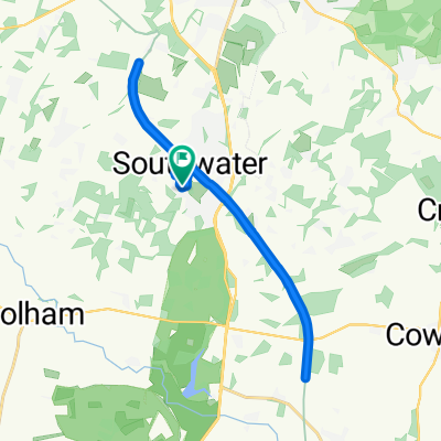
South Lodge Horsham 60km
A cycling route starting in Southwater, England, United Kingdom.
Overview
About this route
- -:--
- Duration
- 120.4 km
- Distance
- 468 m
- Ascent
- 468 m
- Descent
- ---
- Avg. speed
- ---
- Max. altitude
Route quality
Waytypes & surfaces along the route
Waytypes
Road
61.4 km
(51 %)
Quiet road
22.9 km
(19 %)
Surfaces
Paved
39.7 km
(33 %)
Asphalt
39.7 km
(33 %)
Undefined
80.6 km
(67 %)
Continue with Bikemap
Use, edit, or download this cycling route
You would like to ride South Lodge Horsham 60km or customize it for your own trip? Here is what you can do with this Bikemap route:
Free features
- Save this route as favorite or in collections
- Copy & plan your own version of this route
- Split it into stages to create a multi-day tour
- Sync your route with Garmin or Wahoo
Premium features
Free trial for 3 days, or one-time payment. More about Bikemap Premium.
- Navigate this route on iOS & Android
- Export a GPX / KML file of this route
- Create your custom printout (try it for free)
- Download this route for offline navigation
Discover more Premium features.
Get Bikemap PremiumFrom our community
Other popular routes starting in Southwater
 Summers Pond May 2018
- Distance
- 15.8 km
- Ascent
- 106 m
- Descent
- 108 m
- Location
- Southwater, England, United Kingdom
 West Grinstead to Christ Hospital
- Distance
- 18.5 km
- Ascent
- 77 m
- Descent
- 77 m
- Location
- Southwater, England, United Kingdom
 Southwater Relay Triathlon
- Distance
- 18.3 km
- Ascent
- 129 m
- Descent
- 129 m
- Location
- Southwater, England, United Kingdom
 College Road 132, Southwater to College Road 136, Southwater
- Distance
- 10.6 km
- Ascent
- 39 m
- Descent
- 39 m
- Location
- Southwater, England, United Kingdom
 Sumners Pond to Home
- Distance
- 35 km
- Ascent
- 300 m
- Descent
- 250 m
- Location
- Southwater, England, United Kingdom
 45K lap
- Distance
- 45.8 km
- Ascent
- 221 m
- Descent
- 220 m
- Location
- Southwater, England, United Kingdom
 Copsale Road, Horsham to Bar Lane, Horsham
- Distance
- 21.7 km
- Ascent
- 124 m
- Descent
- 127 m
- Location
- Southwater, England, United Kingdom
 Moderate route in Steyning
- Distance
- 23 km
- Ascent
- 132 m
- Descent
- 160 m
- Location
- Southwater, England, United Kingdom
Open it in the app