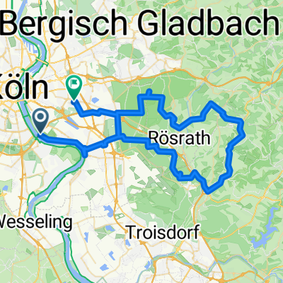
Von Köln nach Karlsruhe - Tag 1/4
A cycling route starting in Poll, North Rhine-Westphalia, Germany.
Overview
About this route
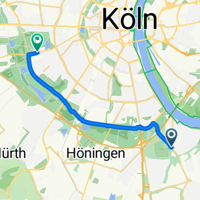
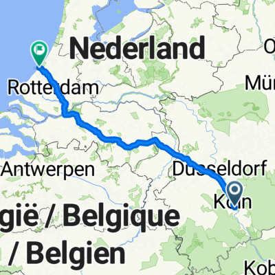
My Easter Tour of 2012
The departure was on Good Friday and the end on Easter Monday in the afternoon in Karlsruhe. The return journey was made with regional trains with transfers in Frankfurt am Main and Koblenz.
The ride on Friday from Cologne to Lahnstein to the campsite 'Uferwiese' was the kickoff. The overnight stay in a tent at just below zero degrees was quite a challenge.
- -:--
- Duration
- 115.5 km
- Distance
- 139 m
- Ascent
- 123 m
- Descent
- ---
- Avg. speed
- ---
- Max. altitude
Route quality
Waytypes & surfaces along the route
Waytypes
Path
56.6 km
(49 %)
Quiet road
21.9 km
(19 %)
Surfaces
Paved
84.3 km
(73 %)
Unpaved
2.3 km
(2 %)
Asphalt
80.9 km
(70 %)
Paved (undefined)
3.5 km
(3 %)
Continue with Bikemap
Use, edit, or download this cycling route
You would like to ride Von Köln nach Karlsruhe - Tag 1/4 or customize it for your own trip? Here is what you can do with this Bikemap route:
Free features
- Save this route as favorite or in collections
- Copy & plan your own version of this route
- Split it into stages to create a multi-day tour
- Sync your route with Garmin or Wahoo
Premium features
Free trial for 3 days, or one-time payment. More about Bikemap Premium.
- Navigate this route on iOS & Android
- Export a GPX / KML file of this route
- Create your custom printout (try it for free)
- Download this route for offline navigation
Discover more Premium features.
Get Bikemap PremiumFrom our community
Other popular routes starting in Poll
- RTC Rodenkirchen RTF Familientour 24 km Planung 2018
- Distance
- 24.5 km
- Ascent
- 44 m
- Descent
- 45 m
- Location
- Poll, North Rhine-Westphalia, Germany
- Rund um Köln
- Distance
- 43.1 km
- Ascent
- 104 m
- Descent
- 108 m
- Location
- Poll, North Rhine-Westphalia, Germany
- Cologne KOLN
- Distance
- 38.3 km
- Ascent
- 81 m
- Descent
- 82 m
- Location
- Poll, North Rhine-Westphalia, Germany
- Poll-Hohkeppel-Altenrath-Poll
- Distance
- 74.5 km
- Ascent
- 289 m
- Descent
- 291 m
- Location
- Poll, North Rhine-Westphalia, Germany
- Englischer Garten Bonn
- Distance
- 65.4 km
- Ascent
- 99 m
- Descent
- 101 m
- Location
- Poll, North Rhine-Westphalia, Germany
- Oberländer Ufer 1, Köln nach Vogtstraße 22, Rheinbrohl
- Distance
- 271.8 km
- Ascent
- 1,613 m
- Descent
- 1,598 m
- Location
- Poll, North Rhine-Westphalia, Germany
- RTF Rodenkirchen
- Distance
- 146.3 km
- Ascent
- 1,168 m
- Descent
- 1,136 m
- Location
- Poll, North Rhine-Westphalia, Germany
- Festungsring Köln
- Distance
- 63.2 km
- Ascent
- 120 m
- Descent
- 122 m
- Location
- Poll, North Rhine-Westphalia, Germany
Open it in the app