

2016 Ride Day 101 - Vesc Circle to Col de la Chaudière
A cycling route starting in Dieulefit, Auvergne-Rhône-Alpes, France.
Overview
About this route
Fantastic ride on zero and low-traffic roads, with the exception of the portion along the Drôme River where there was excellent road shoulder.
Super climbing and descending. We highly recommend this route.
- -:--
- Duration
- 76.9 km
- Distance
- 1,318 m
- Ascent
- 1,319 m
- Descent
- ---
- Avg. speed
- ---
- Avg. speed

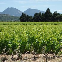
Route photos


Route quality
Waytypes & surfaces along the route
Waytypes
Busy road
43.8 km
(57 %)
Road
26.1 km
(34 %)
Surfaces
Paved
55.3 km
(72 %)
Asphalt
53.3 km
(69 %)
Paved (undefined)
2 km
(3 %)
Undefined
21.6 km
(28 %)
Continue with Bikemap
Use, edit, or download this cycling route
You would like to ride 2016 Ride Day 101 - Vesc Circle to Col de la Chaudière or customize it for your own trip? Here is what you can do with this Bikemap route:
Free features
- Save this route as favorite or in collections
- Copy & plan your own version of this route
- Sync your route with Garmin or Wahoo
Premium features
Free trial for 3 days, or one-time payment. More about Bikemap Premium.
- Navigate this route on iOS & Android
- Export a GPX / KML file of this route
- Create your custom printout (try it for free)
- Download this route for offline navigation
Discover more Premium features.
Get Bikemap PremiumFrom our community
Other popular routes starting in Dieulefit
 2016 Ride Day 99 - Vesc Circle
- Distance
- 40.1 km
- Ascent
- 782 m
- Descent
- 781 m
- Location
- Dieulefit, Auvergne-Rhône-Alpes, France
 Col de la Chaudière
- Distance
- 91.8 km
- Ascent
- 1,616 m
- Descent
- 1,620 m
- Location
- Dieulefit, Auvergne-Rhône-Alpes, France
 2016 Ride Day 102 - Vesc Circle to St-Nazaire-le-Désert
- Distance
- 52.5 km
- Ascent
- 1,048 m
- Descent
- 1,048 m
- Location
- Dieulefit, Auvergne-Rhône-Alpes, France
 53k Dieulefit
- Distance
- 52.3 km
- Ascent
- 821 m
- Descent
- 815 m
- Location
- Dieulefit, Auvergne-Rhône-Alpes, France
 2014 sainte jalle nord 109 km
- Distance
- 108.7 km
- Ascent
- 1,782 m
- Descent
- 1,803 m
- Location
- Dieulefit, Auvergne-Rhône-Alpes, France
 2016 Ride Day 100 - Vesc Circle to Valréas
- Distance
- 75.5 km
- Ascent
- 713 m
- Descent
- 713 m
- Location
- Dieulefit, Auvergne-Rhône-Alpes, France
 2016 Ride Day 101 - Vesc Circle to Col de la Chaudière
- Distance
- 76.9 km
- Ascent
- 1,318 m
- Descent
- 1,319 m
- Location
- Dieulefit, Auvergne-Rhône-Alpes, France
 Etape 4 Eté 2022
- Distance
- 48.8 km
- Ascent
- 743 m
- Descent
- 840 m
- Location
- Dieulefit, Auvergne-Rhône-Alpes, France
Open it in the app