

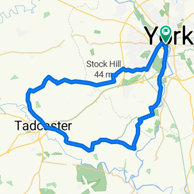
Yorkshire
A cycling route starting in York, England, United Kingdom.
Overview
About this route
-
York-Glenfield Caravan Park 38,5/38,5 km
-
Glenfield-Otley 27/65,5 km
-
Otley-Bolton Abbey 25/90,5 km
-
Bolton Abbey
-
Bolton Abbey-Skipton-Bolton Abbey 17,5/108 km
-
Bolton Abbey-Threshfield 21/129 km
-
Threshfield-Kettlewell 11/140 km
-
Kettlewell-Newbiggin (Aysgarth) 24/164 km
-
Newbiggin-Redmire 10/174 km
-
Redmire-Ripon 41/215 km
-
Ripon-Harrogate 25/240 km
-
York
- -:--
- Duration
- 243.3 km
- Distance
- 886 m
- Ascent
- 784 m
- Descent
- ---
- Avg. speed
- ---
- Max. altitude

Route quality
Waytypes & surfaces along the route
Waytypes
Busy road
102.7 km
(42 %)
Road
58.7 km
(24 %)
Surfaces
Paved
93.7 km
(39 %)
Unpaved
4.3 km
(2 %)
Asphalt
88.9 km
(37 %)
Paved (undefined)
4.8 km
(2 %)
Route highlights
Points of interest along the route

Accommodation after 36.4 km
Glenfield Caravan Park £10
Accommodation after 63.7 km
Dowgill House B&B £60
Accommodation after 88.8 km
Catgill Campsite £10 x 3
Accommodation after 128.5 km
Wood Nook Caravan Park £8
Accommodation after 138.3 km
Kettlewell Camping £8
Accommodation after 155.1 km
Street Head Caravan Park £8
Accommodation after 170.7 km
The Bolton Arms £50
Accommodation after 212.4 km
River Laver Holiday Park £15
Continue with Bikemap
Use, edit, or download this cycling route
You would like to ride Yorkshire or customize it for your own trip? Here is what you can do with this Bikemap route:
Free features
- Save this route as favorite or in collections
- Copy & plan your own version of this route
- Split it into stages to create a multi-day tour
- Sync your route with Garmin or Wahoo
Premium features
Free trial for 3 days, or one-time payment. More about Bikemap Premium.
- Navigate this route on iOS & Android
- Export a GPX / KML file of this route
- Create your custom printout (try it for free)
- Download this route for offline navigation
Discover more Premium features.
Get Bikemap PremiumFrom our community
Other popular routes starting in York
 The Southern Loop
- Distance
- 43.2 km
- Ascent
- 72 m
- Descent
- 72 m
- Location
- York, England, United Kingdom
 York - Westow - York
- Distance
- 64.9 km
- Ascent
- 118 m
- Descent
- 114 m
- Location
- York, England, United Kingdom
 Barton le willows
- Distance
- 49 km
- Ascent
- 141 m
- Descent
- 163 m
- Location
- York, England, United Kingdom
 York to Newton-upon-Ouse
- Distance
- 17.5 km
- Ascent
- 693 m
- Descent
- 697 m
- Location
- York, England, United Kingdom
 Tockwith Spotted Ox
- Distance
- 54.1 km
- Ascent
- 115 m
- Descent
- 110 m
- Location
- York, England, United Kingdom
 37 Monkgate, York to 33 Huntington Road, York
- Distance
- 16.1 km
- Ascent
- 6 m
- Descent
- 13 m
- Location
- York, England, United Kingdom
 York - Crayke - York via Easingwold
- Distance
- 63.9 km
- Ascent
- 117 m
- Descent
- 115 m
- Location
- York, England, United Kingdom
 Yorkshire
- Distance
- 243.3 km
- Ascent
- 886 m
- Descent
- 784 m
- Location
- York, England, United Kingdom
Open it in the app