Kamechy-Velka Cena-Veveri
A cycling route starting in Troubsko, South Moravian, Czechia.
Overview
About this route
- -:--
- Duration
- 23.4 km
- Distance
- 397 m
- Ascent
- 391 m
- Descent
- ---
- Avg. speed
- ---
- Max. altitude
Route quality
Waytypes & surfaces along the route
Waytypes
Track
8.9 km
(38 %)
Road
3.5 km
(15 %)
Surfaces
Paved
13.8 km
(59 %)
Unpaved
4.5 km
(19 %)
Asphalt
13.6 km
(58 %)
Ground
3 km
(13 %)
Continue with Bikemap
Use, edit, or download this cycling route
You would like to ride Kamechy-Velka Cena-Veveri or customize it for your own trip? Here is what you can do with this Bikemap route:
Free features
- Save this route as favorite or in collections
- Copy & plan your own version of this route
- Sync your route with Garmin or Wahoo
Premium features
Free trial for 3 days, or one-time payment. More about Bikemap Premium.
- Navigate this route on iOS & Android
- Export a GPX / KML file of this route
- Create your custom printout (try it for free)
- Download this route for offline navigation
Discover more Premium features.
Get Bikemap PremiumFrom our community
Other popular routes starting in Troubsko
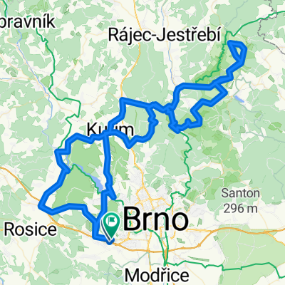
26.4.2010 Ztracená cesta- Distance
- 29.6 km
- Ascent
- 507 m
- Descent
- 505 m
- Location
- Troubsko, South Moravian, Czechia
BÃlý potok- Distance
- 54.6 km
- Ascent
- 948 m
- Descent
- 1,004 m
- Location
- Troubsko, South Moravian, Czechia
to Motodrom from Bystrec- Distance
- 13.1 km
- Ascent
- 317 m
- Descent
- 298 m
- Location
- Troubsko, South Moravian, Czechia
Kamechy-Velka Cena-Veveri- Distance
- 23.4 km
- Ascent
- 397 m
- Descent
- 391 m
- Location
- Troubsko, South Moravian, Czechia
Jirkovo utrpeni- Distance
- 54.3 km
- Ascent
- 695 m
- Descent
- 727 m
- Location
- Troubsko, South Moravian, Czechia
smelcovna- Distance
- 38.4 km
- Ascent
- 446 m
- Descent
- 445 m
- Location
- Troubsko, South Moravian, Czechia
Brno - Železná- Distance
- 256.7 km
- Ascent
- 2,647 m
- Descent
- 2,707 m
- Location
- Troubsko, South Moravian, Czechia
3. Etappe - Brno to Tábor - Saturday 28th April- Distance
- 166.7 km
- Ascent
- 1,302 m
- Descent
- 1,106 m
- Location
- Troubsko, South Moravian, Czechia
Open it in the app

