

Auf die Alb durchs Lautertal und zurück
A cycling route starting in Eberhardzell, Baden-Wurttemberg, Germany.
Overview
About this route
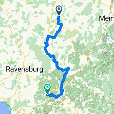
Eberhardzell - Schienenhof - Oggelshausen - Seekirch - Brasenberg - Uttenweiler - Uigendorf - Dietenhofen - Reutlingendorf - Obermarchtal - Rechtenstein - Hayingen - Indelhausen - Gundelfingen - Buttenhausen - Apfelstetten - Oberheutal - Mehrstetten - Sondernach - Tiefenhülen - Frankenhofen - Granheim - Erbstetten - Unterwilzingen - Lauterach - Untermarchtal - Hausen am Bussen - Oberwachingen - Dieterskirch - Sauggart - Rupptertshofen - Attenweiler - Gutershofen - Stafflangen - Mittelbiberach - Reute - Degernau - Hochdorf - Unteressendorf - Scharben - Eberhardzell
- -:--
- Duration
- 151.9 km
- Distance
- 881 m
- Ascent
- 881 m
- Descent
- ---
- Avg. speed
- ---
- Max. altitude
Route quality
Waytypes & surfaces along the route
Waytypes
Road
54.7 km
(36 %)
Quiet road
41 km
(27 %)
Surfaces
Paved
80.5 km
(53 %)
Unpaved
1.5 km
(1 %)
Asphalt
77.5 km
(51 %)
Paved (undefined)
3 km
(2 %)
Continue with Bikemap
Use, edit, or download this cycling route
You would like to ride Auf die Alb durchs Lautertal und zurück or customize it for your own trip? Here is what you can do with this Bikemap route:
Free features
- Save this route as favorite or in collections
- Copy & plan your own version of this route
- Split it into stages to create a multi-day tour
- Sync your route with Garmin or Wahoo
Premium features
Free trial for 3 days, or one-time payment. More about Bikemap Premium.
- Navigate this route on iOS & Android
- Export a GPX / KML file of this route
- Create your custom printout (try it for free)
- Download this route for offline navigation
Discover more Premium features.
Get Bikemap PremiumFrom our community
Other popular routes starting in Eberhardzell
 Eberhardzell - Amtzell
- Distance
- 71.6 km
- Ascent
- 859 m
- Descent
- 880 m
- Location
- Eberhardzell, Baden-Wurttemberg, Germany
 Eberhardzell nach Biberach
- Distance
- 14.2 km
- Ascent
- 89 m
- Descent
- 166 m
- Location
- Eberhardzell, Baden-Wurttemberg, Germany
 O'essendorf Zollenreute Ebersbach Fulgenstadt
- Distance
- 68.2 km
- Ascent
- 245 m
- Descent
- 287 m
- Location
- Eberhardzell, Baden-Wurttemberg, Germany
 Oberessendorf Waldsee Aulendorf Saulgau
- Distance
- 80.1 km
- Ascent
- 283 m
- Descent
- 326 m
- Location
- Eberhardzell, Baden-Wurttemberg, Germany
 Oberessendorf Ringschnait Äpfingen O´stadion
- Distance
- 76.1 km
- Ascent
- 327 m
- Descent
- 367 m
- Location
- Eberhardzell, Baden-Wurttemberg, Germany
 Rundfahrt Eberhardzell durchs Ländle
- Distance
- 31.7 km
- Ascent
- 181 m
- Descent
- 181 m
- Location
- Eberhardzell, Baden-Wurttemberg, Germany
 Pfänder
- Distance
- 157.9 km
- Ascent
- 1,130 m
- Descent
- 1,131 m
- Location
- Eberhardzell, Baden-Wurttemberg, Germany
 Auf die Alb durchs Lautertal und zurück
- Distance
- 151.9 km
- Ascent
- 881 m
- Descent
- 881 m
- Location
- Eberhardzell, Baden-Wurttemberg, Germany
Open it in the app