

Lahm - Wiesen und zurück
A cycling route starting in Untermerzbach, Bavaria, Germany.
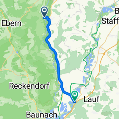
Overview
About this route
Leisurely hike near the Eierbergen
- -:--
- Duration
- 16 km
- Distance
- 270 m
- Ascent
- 274 m
- Descent
- ---
- Avg. speed
- ---
- Max. altitude

Route quality
Waytypes & surfaces along the route
Waytypes
Track
13.8 km
(86 %)
Quiet road
1.4 km
(9 %)
Surfaces
Paved
5.9 km
(37 %)
Unpaved
8.8 km
(55 %)
Gravel
4.2 km
(26 %)
Ground
2.9 km
(18 %)
Continue with Bikemap
Use, edit, or download this cycling route
You would like to ride Lahm - Wiesen und zurück or customize it for your own trip? Here is what you can do with this Bikemap route:
Free features
- Save this route as favorite or in collections
- Copy & plan your own version of this route
- Sync your route with Garmin or Wahoo
Premium features
Free trial for 3 days, or one-time payment. More about Bikemap Premium.
- Navigate this route on iOS & Android
- Export a GPX / KML file of this route
- Create your custom printout (try it for free)
- Download this route for offline navigation
Discover more Premium features.
Get Bikemap PremiumFrom our community
Other popular routes starting in Untermerzbach
 HolyLands Shorty
- Distance
- 65.7 km
- Ascent
- 613 m
- Descent
- 613 m
- Location
- Untermerzbach, Bavaria, Germany
 kleine runde um herreth
- Distance
- 27.6 km
- Ascent
- 344 m
- Descent
- 343 m
- Location
- Untermerzbach, Bavaria, Germany
 Radscher See
- Distance
- 60.4 km
- Ascent
- 492 m
- Descent
- 380 m
- Location
- Untermerzbach, Bavaria, Germany
 Lahm - Wiesen und zurück
- Distance
- 16 km
- Ascent
- 270 m
- Descent
- 274 m
- Location
- Untermerzbach, Bavaria, Germany
 Große Rampenrunde FB33-Edition unfinished
- Distance
- 103.9 km
- Ascent
- 825 m
- Descent
- 891 m
- Location
- Untermerzbach, Bavaria, Germany
 Steady Sonntag Route In Itzgrund
- Distance
- 19.4 km
- Ascent
- 117 m
- Descent
- 38 m
- Location
- Untermerzbach, Bavaria, Germany
 Von Hemmendorf nach Nürnberg
- Distance
- 88.6 km
- Ascent
- 121 m
- Descent
- 94 m
- Location
- Untermerzbach, Bavaria, Germany
 Hemmendorf nach Ebing
- Distance
- 14.2 km
- Ascent
- 38 m
- Descent
- 53 m
- Location
- Untermerzbach, Bavaria, Germany
Open it in the app