
half Douglas trail
- 34.7 km
- 113 m
- 116 m
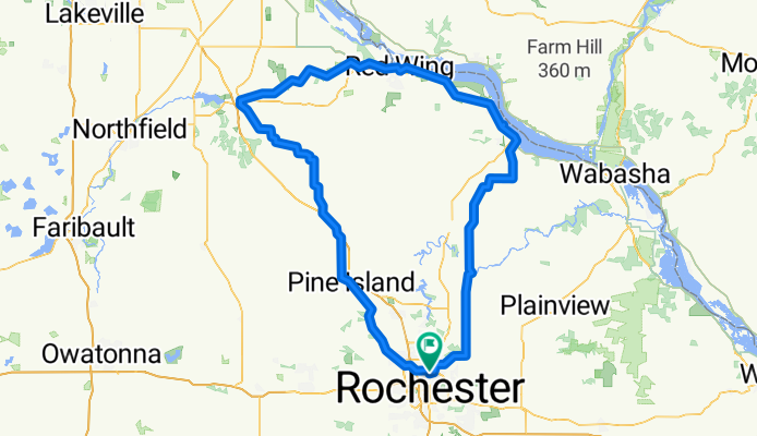
- Rochester, Minnesota, United States
A scalene triangle is formed by this 3 day trek from Rochester to Cannon Falls (Day 1), Cannon Falls to Hok Si Lah Park (Day 2), Hok Si Lah Park to Rochester (Day 3).
Cycleway
72.9 km37 %Quiet road
67 km34 %Paved
116.3 km(59 %)Unpaved
61.1 km(31 %)Asphalt
94.6 km48 %Gravel
57.2 km29 %Free trial for 3 days, or one-time payment. More about Bikemap Premium.
Discover more Premium features.
Get Bikemap PremiumOpen it in the app