Tübingen - Plochingen
- 50.1 km
- 649 m
- 713 m
- Kirchentellinsfurt, Baden-Wurttemberg, Germany
A cycling route starting in Kirchentellinsfurt, Baden-Wurttemberg, Germany.
Overview
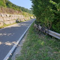
TEASI track; cycle path along the Neckar from Nürtingen. Short unpaved sections
created this 9 years ago
Route quality
Track
7.1 km
(21 %)
Cycleway
5.4 km
(16 %)
Paved
30.4 km
(90 %)
Unpaved
2 km
(6 %)
Asphalt
29 km
(86 %)
Loose gravel
1.3 km
(4 %)
Continue with Bikemap
You would like to ride NH - Nürtingen - Tübingen.gpx or customize it for your own trip? Here is what you can do with this Bikemap route:
Free trial for 3 days, or one-time payment. More about Bikemap Premium.
Discover more Premium features.
Get Bikemap PremiumFrom our community
Open it in the app