

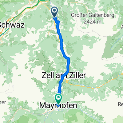
Zillertal...Spieljoch-Hochfugen-Fugen
A cycling route starting in Fügenberg, Tyrol, Austria.
Overview
About this route
TEASI track
- -:--
- Duration
- 24.4 km
- Distance
- 294 m
- Ascent
- 1,506 m
- Descent
- ---
- Avg. speed
- ---
- Max. altitude

Continue with Bikemap
Use, edit, or download this cycling route
You would like to ride Zillertal...Spieljoch-Hochfugen-Fugen or customize it for your own trip? Here is what you can do with this Bikemap route:
Free features
- Save this route as favorite or in collections
- Copy & plan your own version of this route
- Sync your route with Garmin or Wahoo
Premium features
Free trial for 3 days, or one-time payment. More about Bikemap Premium.
- Navigate this route on iOS & Android
- Export a GPX / KML file of this route
- Create your custom printout (try it for free)
- Download this route for offline navigation
Discover more Premium features.
Get Bikemap PremiumFrom our community
Other popular routes starting in Fügenberg
 Gagaring - Mayerhofen
- Distance
- 26.2 km
- Ascent
- 163 m
- Descent
- 60 m
- Location
- Fügenberg, Tyrol, Austria
 Brandenberg
- Distance
- 72.7 km
- Ascent
- 1,348 m
- Descent
- 1,349 m
- Location
- Fügenberg, Tyrol, Austria
 Hall in Tirol versie 2
- Distance
- 81.1 km
- Ascent
- 1,099 m
- Descent
- 1,101 m
- Location
- Fügenberg, Tyrol, Austria
 Biergarten und Pizza Runde
- Distance
- 48.9 km
- Ascent
- 186 m
- Descent
- 189 m
- Location
- Fügenberg, Tyrol, Austria
 Brandberg+Hintertux+Niederhart
- Distance
- 118 km
- Ascent
- 1,975 m
- Descent
- 1,975 m
- Location
- Fügenberg, Tyrol, Austria
 Zillergrund
- Distance
- 94 km
- Ascent
- 1,940 m
- Descent
- 1,940 m
- Location
- Fügenberg, Tyrol, Austria
 Koningsleiten-Gerlosberg
- Distance
- 104.1 km
- Ascent
- 1,684 m
- Descent
- 1,684 m
- Location
- Fügenberg, Tyrol, Austria
 fugen 1
- Distance
- 32.6 km
- Ascent
- 291 m
- Descent
- 292 m
- Location
- Fügenberg, Tyrol, Austria
Open it in the app