

11. Abschnitt-Werra-Burgen-Steig Hessen
A cycling route starting in Herleshausen, Hesse, Germany.
Overview
About this route
Just before the hotel gate entrance, follow the path to the right and immediately after to the left, passing some agricultural buildings. On the right, a striking half-timbered building with a tower catches the eye. A few steps further, at the fork, keep to the left and walk on the paved path with views over meadows and fields, gently ascending. Upon reaching the height and thus the forest edge, continue straight ahead and walk on the flat, wide forest road for about 1.6 km through the woods. After leaving the forest, follow the marker into a meadow hollow. Opposite a transformer house, a path branches off to the left; shortly after crossing a stream, you stand in front of federal road B400. On the opposite side, the path continues to the left and leads past fields to the forest. Following the forest edge to the right, after about 600 m, with the end of the forest already in sight, turn left and cross the narrow woodland. Here you have reached the Gerbach valley with the Gerkbach and walk on the comfortable path to the left. You soon reach two ponds, between which the Werra-Burgen-Steig Hessen runs and then continues to the right. Just a few meters further, again keep right on the crossing path and walk again along the forest edge. After nearly 1 km – on the right you look over fields towards the federal road – at the junction turn sharply left towards Blankenbach. Caution: after only about 50 m you have to turn right again! The wide path continues to rise; after about 1.2 km, turn right and about 300 m further, sharply right again. Shortly afterward, leave the path at the left curve, descend right and shortly meet another path that takes you out of the forest. With a view of Blankenbach, walk down the slope, change at the sharp left curve onto the straight field path and reach the outskirts of Blankenbach with a resting place and hiking portal. The Werra-Burgen-Steig Hessen turns to the left, then shortly after leads right along a meadow path on the edge of the village. At the height of a single house, walk to the state road, cross it and initially follow Wildecker Straße. Once it bends to the right, turn left into Steingraben street, which becomes a field path at the edge of the town and leads to a resting place. From the resting place, the hike continues up a rising meadow path straight to the height. Once the path meets the forest edge, walk left through fields and leave the wide path at the next curve. On the meadow path branching off to the right here, pass the forest edge; after nearly 250 m, walk left into the forest. At the junction shortly after (about 130 m), the marker points to the right. After the same distance, descend left again to a wide forestry road used for forestry. To the right, a large junction is quickly reached, which the path crosses straight ahead. You meet a forest road, which you follow right to the "Drei Kastanien" hiking car park. From the car park, follow the gently downhill forest road for about 150 m, then go down the path branching half-right and follow the signposted Alpine trail towards Tannenburg past a spring. Keep right and cross the next path to the left to then turn half-right after a few steps onto a nice trail that leads you directly to the destination Tannenburg and thus to the end of the Werra-Burgen-Steig Hessen. It is still about 1.3 km to the center of Nentershausen.
- -:--
- Duration
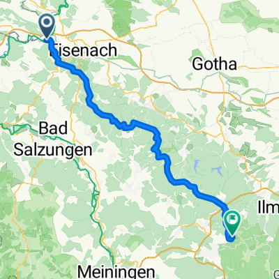
- 16 km
- Distance
- 420 m
- Ascent
- 352 m
- Descent
- ---
- Avg. speed
- ---
- Max. altitude

Continue with Bikemap
Use, edit, or download this cycling route
You would like to ride 11. Abschnitt-Werra-Burgen-Steig Hessen or customize it for your own trip? Here is what you can do with this Bikemap route:
Free features
- Save this route as favorite or in collections
- Copy & plan your own version of this route
- Sync your route with Garmin or Wahoo
Premium features
Free trial for 3 days, or one-time payment. More about Bikemap Premium.
- Navigate this route on iOS & Android
- Export a GPX / KML file of this route
- Create your custom printout (try it for free)
- Download this route for offline navigation
Discover more Premium features.
Get Bikemap PremiumFrom our community
Other popular routes starting in Herleshausen
 WTR - RÖN - REN
- Distance
- 80.6 km
- Ascent
- 605 m
- Descent
- 605 m
- Location
- Herleshausen, Hesse, Germany
 Werra-Fulda als Rundkurs
- Distance
- 293.3 km
- Ascent
- 326 m
- Descent
- 328 m
- Location
- Herleshausen, Hesse, Germany
 Waldstraße 20, Herleshausen nach Waldstraße 20, Herleshausen
- Distance
- 18.3 km
- Ascent
- 422 m
- Descent
- 423 m
- Location
- Herleshausen, Hesse, Germany
 2016-09-11: WTR - UW - RRH - RGH
- Distance
- 90.1 km
- Ascent
- 694 m
- Descent
- 695 m
- Location
- Herleshausen, Hesse, Germany
 Harz-Eichsfeld-Rennsteig 3. Tag
- Distance
- 77.4 km
- Ascent
- 1,230 m
- Descent
- 816 m
- Location
- Herleshausen, Hesse, Germany
 Werra Herleshausen - ESW
- Distance
- 66.8 km
- Ascent
- 390 m
- Descent
- 433 m
- Location
- Herleshausen, Hesse, Germany
 11. Abschnitt-Werra-Burgen-Steig Hessen
- Distance
- 16 km
- Ascent
- 420 m
- Descent
- 352 m
- Location
- Herleshausen, Hesse, Germany
 2016-09-10: Werratal - Rennsteig
- Distance
- 81.1 km
- Ascent
- 591 m
- Descent
- 591 m
- Location
- Herleshausen, Hesse, Germany
Open it in the app