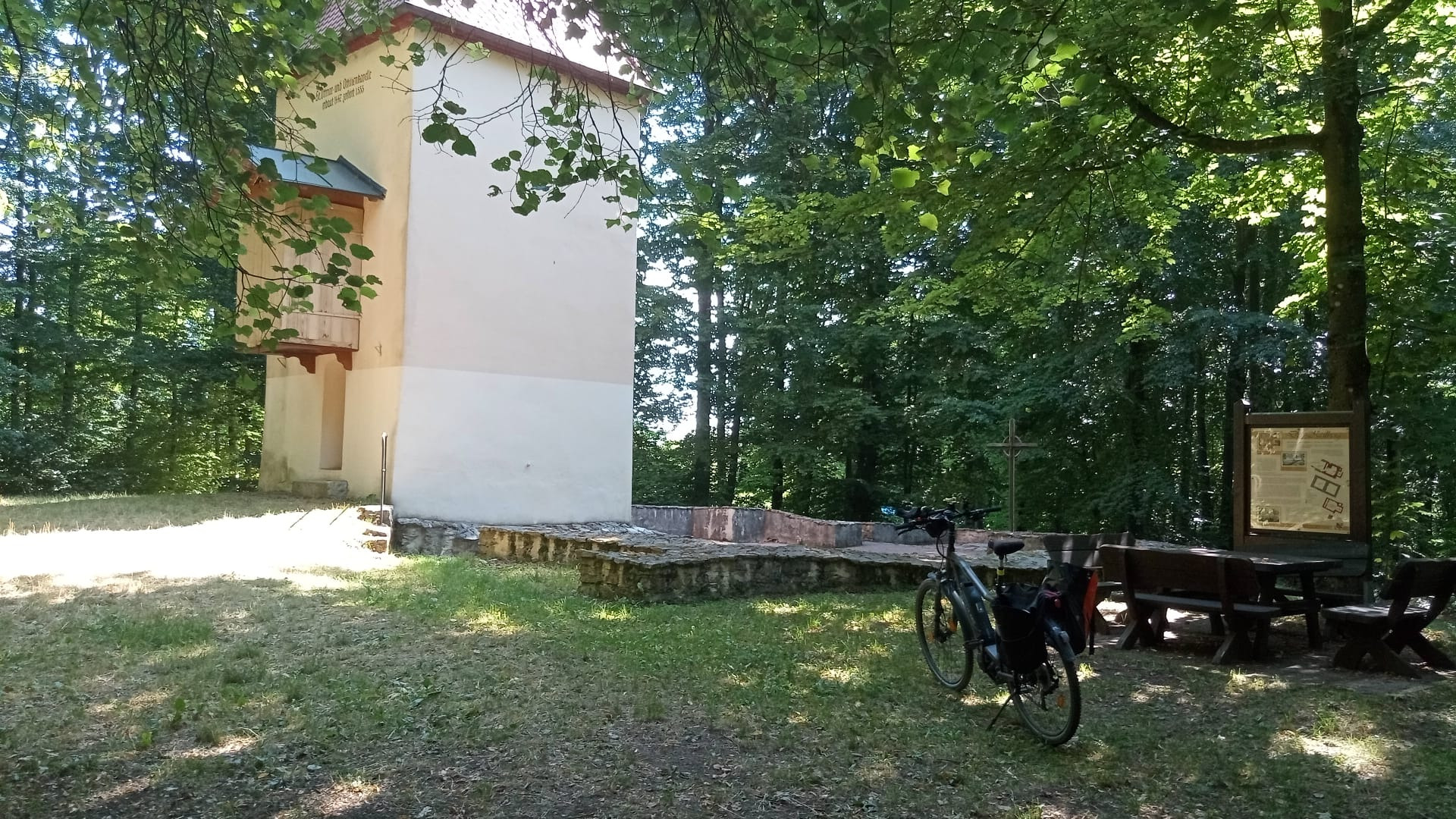
Nürnberger Land
A cycling route starting in Neunkirchen am Sand, Bavaria, Germany.
Overview
About this route
*01.07.2016
in 4 hours on bike paths from Neunkirchen/Sand to Offenhausen, then on asphalt over the mountain to Altdorf, through Winkelhaid to Feucht, Altenfurt and Fischbach in the Lorenzer Forest through Brunn to Birkensee in Schwaig and back to Neunkirchen via Röthenbach and Lauf.
- -:--
- Duration
- 78.3 km
- Distance
- 449 m
- Ascent
- 443 m
- Descent
- ---
- Avg. speed
- ---
- Max. altitude
Route quality
Waytypes & surfaces along the route
Waytypes
Path
21.2 km
(27 %)
Track
20.4 km
(26 %)
Surfaces
Paved
54.1 km
(69 %)
Unpaved
14.9 km
(19 %)
Asphalt
49.4 km
(63 %)
Gravel
11 km
(14 %)
Continue with Bikemap
Use, edit, or download this cycling route
You would like to ride Nürnberger Land or customize it for your own trip? Here is what you can do with this Bikemap route:
Free features
- Save this route as favorite or in collections
- Copy & plan your own version of this route
- Sync your route with Garmin or Wahoo
Premium features
Free trial for 3 days, or one-time payment. More about Bikemap Premium.
- Navigate this route on iOS & Android
- Export a GPX / KML file of this route
- Create your custom printout (try it for free)
- Download this route for offline navigation
Discover more Premium features.
Get Bikemap PremiumFrom our community
Other popular routes starting in Neunkirchen am Sand
- Keilberg Kirche
- Distance
- 46.3 km
- Ascent
- 611 m
- Descent
- 614 m
- Location
- Neunkirchen am Sand, Bavaria, Germany
- Lauf-Kunigundenberg
- Distance
- 15.2 km
- Ascent
- 230 m
- Descent
- 228 m
- Location
- Neunkirchen am Sand, Bavaria, Germany
- Um den Hohenstein herum
- Distance
- 34.3 km
- Ascent
- 752 m
- Descent
- 753 m
- Location
- Neunkirchen am Sand, Bavaria, Germany
- Weigendorf - Oed
- Distance
- 44.5 km
- Ascent
- 133 m
- Descent
- 133 m
- Location
- Neunkirchen am Sand, Bavaria, Germany
- Morsbrunn
- Distance
- 23.7 km
- Ascent
- 387 m
- Descent
- 384 m
- Location
- Neunkirchen am Sand, Bavaria, Germany
- Sp22Speikern-Wolfshöhe-Großbellhofen-Hedersdorf-Speikern
- Distance
- 21.2 km
- Ascent
- 308 m
- Descent
- 309 m
- Location
- Neunkirchen am Sand, Bavaria, Germany
- SP23MSpeikern-Reichenschwand-Rüblanden-Lauf-Heuchling-zurück
- Distance
- 22.7 km
- Ascent
- 221 m
- Descent
- 221 m
- Location
- Neunkirchen am Sand, Bavaria, Germany
- Kirchröttenbach
- Distance
- 21.6 km
- Ascent
- 183 m
- Descent
- 185 m
- Location
- Neunkirchen am Sand, Bavaria, Germany
Open it in the app