

Nördlicher Rupertigau
A cycling route starting in Taching am See, Bavaria, Germany.
Overview
About this route
- -:--
- Duration
- 38.1 km
- Distance
- 291 m
- Ascent
- 290 m
- Descent
- ---
- Avg. speed
- ---
- Max. altitude
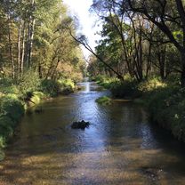
Route photos


Route quality
Waytypes & surfaces along the route
Waytypes
Quiet road
26.1 km
(68 %)
Road
4.9 km
(13 %)
Surfaces
Paved
28.4 km
(75 %)
Unpaved
3.2 km
(8 %)
Asphalt
28.3 km
(74 %)
Gravel
3 km
(8 %)
Continue with Bikemap
Use, edit, or download this cycling route
You would like to ride Nördlicher Rupertigau or customize it for your own trip? Here is what you can do with this Bikemap route:
Free features
- Save this route as favorite or in collections
- Copy & plan your own version of this route
- Sync your route with Garmin or Wahoo
Premium features
Free trial for 3 days, or one-time payment. More about Bikemap Premium.
- Navigate this route on iOS & Android
- Export a GPX / KML file of this route
- Create your custom printout (try it for free)
- Download this route for offline navigation
Discover more Premium features.
Get Bikemap PremiumFrom our community
Other popular routes starting in Taching am See
 Tettenhausen-Laufen
- Distance
- 38 km
- Ascent
- 293 m
- Descent
- 293 m
- Location
- Taching am See, Bavaria, Germany
 Lange Ausfahrt durch Taching am See
- Distance
- 44.5 km
- Ascent
- 246 m
- Descent
- 245 m
- Location
- Taching am See, Bavaria, Germany
 B: Tengling - Tittmoning - HOME
- Distance
- 41 km
- Ascent
- 213 m
- Descent
- 234 m
- Location
- Taching am See, Bavaria, Germany
 Nördlicher Rupertigau
- Distance
- 38.1 km
- Ascent
- 291 m
- Descent
- 290 m
- Location
- Taching am See, Bavaria, Germany
 Waginger See Über Mühlberg
- Distance
- 22.3 km
- Ascent
- 204 m
- Descent
- 204 m
- Location
- Taching am See, Bavaria, Germany
 Rund um Waginger See
- Distance
- 35.4 km
- Ascent
- 305 m
- Descent
- 305 m
- Location
- Taching am See, Bavaria, Germany
 Tettenhausen-Fridolfing-Tittmoning an der Salzach und zurück
- Distance
- 38.7 km
- Ascent
- 242 m
- Descent
- 242 m
- Location
- Taching am See, Bavaria, Germany
 Sommerroute.Salzburger-Land.400 km
- Distance
- 384.4 km
- Ascent
- 6,001 m
- Descent
- 5,996 m
- Location
- Taching am See, Bavaria, Germany
Open it in the app