

Senderos de Tórtola: Desde Tórtola hasta Valdeganga de Cuenca
A cycling route starting in Villar de Olalla, Castille-La Mancha, Spain.
Overview
About this route
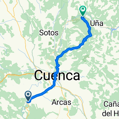
This trail takes us from the small village of Tórtola to Valdeganda de Cuenca, where we can enjoy beautiful places along the way.
- -:--
- Duration
- 6.5 km
- Distance
- 141 m
- Ascent
- 204 m
- Descent
- ---
- Avg. speed
- 1,077 m
- Max. altitude

Route quality
Waytypes & surfaces along the route
Waytypes
Track
5.9 km
(92 %)
Access road
0.3 km
(5 %)
Quiet road
0.2 km
(3 %)
Surfaces
Unpaved
5.9 km
(92 %)
Gravel
4.7 km
(73 %)
Ground
1.2 km
(19 %)
Undefined
0.5 km
(8 %)
Continue with Bikemap
Use, edit, or download this cycling route
You would like to ride Senderos de Tórtola: Desde Tórtola hasta Valdeganga de Cuenca or customize it for your own trip? Here is what you can do with this Bikemap route:
Free features
- Save this route as favorite or in collections
- Copy & plan your own version of this route
- Sync your route with Garmin or Wahoo
Premium features
Free trial for 3 days, or one-time payment. More about Bikemap Premium.
- Navigate this route on iOS & Android
- Export a GPX / KML file of this route
- Create your custom printout (try it for free)
- Download this route for offline navigation
Discover more Premium features.
Get Bikemap PremiumFrom our community
Other popular routes starting in Villar de Olalla
 Hortizuela
- Distance
- 28.8 km
- Ascent
- 303 m
- Descent
- 303 m
- Location
- Villar de Olalla, Castille-La Mancha, Spain
 Senderos de Tórtola: Desde Tórtola a Olmedilla de Arcas y Vuelta a Tórtola
- Distance
- 17.5 km
- Ascent
- 368 m
- Descent
- 376 m
- Location
- Villar de Olalla, Castille-La Mancha, Spain
 Senderos de Tórtola: Desde Tórtola hasta Villar del Saz de Arcas II
- Distance
- 6.7 km
- Ascent
- 211 m
- Descent
- 67 m
- Location
- Villar de Olalla, Castille-La Mancha, Spain
 Tórtola - Villar del Saz - Olmeda del Rey - Valeria - Parra de las Vegas - Valdeganga de Cuenca - Tórtola
- Distance
- 56.3 km
- Ascent
- 643 m
- Descent
- 644 m
- Location
- Villar de Olalla, Castille-La Mancha, Spain
 cuenca-hortizuela-naharros-cuenca
- Distance
- 99.4 km
- Ascent
- 987 m
- Descent
- 987 m
- Location
- Villar de Olalla, Castille-La Mancha, Spain
 Villar de Olalla - Villalba de la Sierra
- Distance
- 46.5 km
- Ascent
- 414 m
- Descent
- 185 m
- Location
- Villar de Olalla, Castille-La Mancha, Spain
 Senderos de Tórtola: Desde Tórtola hasta Villar del Saz de Arcas I
- Distance
- 9.1 km
- Ascent
- 275 m
- Descent
- 91 m
- Location
- Villar de Olalla, Castille-La Mancha, Spain
 De Plaza Mayor, 2, Arcas a Calle Castelar, 3, Fuentes
- Distance
- 11.2 km
- Ascent
- 137 m
- Descent
- 78 m
- Location
- Villar de Olalla, Castille-La Mancha, Spain
Open it in the app