

Große Mühlviertel-Runde
A cycling route starting in Engerwitzdorf, Upper Austria, Austria.
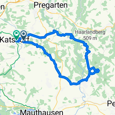
Overview
About this route
A long and beautiful Mühlviertel loop with almost 2,000 meters of elevation gain and many 'peaks'.
- -:--
- Duration
- 91.7 km
- Distance
- 1,571 m
- Ascent
- 1,570 m
- Descent
- ---
- Avg. speed
- ---
- Max. altitude

Route photos

Route quality
Waytypes & surfaces along the route
Waytypes
Quiet road
42.2 km
(46 %)
Road
39.4 km
(43 %)
Surfaces
Paved
38.5 km
(42 %)
Unpaved
2.8 km
(3 %)
Asphalt
37.6 km
(41 %)
Gravel
1.8 km
(2 %)
Continue with Bikemap
Use, edit, or download this cycling route
You would like to ride Große Mühlviertel-Runde or customize it for your own trip? Here is what you can do with this Bikemap route:
Free features
- Save this route as favorite or in collections
- Copy & plan your own version of this route
- Split it into stages to create a multi-day tour
- Sync your route with Garmin or Wahoo
Premium features
Free trial for 3 days, or one-time payment. More about Bikemap Premium.
- Navigate this route on iOS & Android
- Export a GPX / KML file of this route
- Create your custom printout (try it for free)
- Download this route for offline navigation
Discover more Premium features.
Get Bikemap PremiumFrom our community
Other popular routes starting in Engerwitzdorf
 MB-Schwarzbergerhofrunde
- Distance
- 56.9 km
- Ascent
- 854 m
- Descent
- 861 m
- Location
- Engerwitzdorf, Upper Austria, Austria
 Untervisnitz_Dingdorf übe Pferdeeisenbahn CLONED FROM ROUTE 594666
- Distance
- 25.8 km
- Ascent
- 469 m
- Descent
- 469 m
- Location
- Engerwitzdorf, Upper Austria, Austria
 Kollmitzberg - Neustadtl
- Distance
- 113.4 km
- Ascent
- 545 m
- Descent
- 542 m
- Location
- Engerwitzdorf, Upper Austria, Austria
 Bodendorf nach Ortsplatz
- Distance
- 30.9 km
- Ascent
- 738 m
- Descent
- 724 m
- Location
- Engerwitzdorf, Upper Austria, Austria
 Aisttal 1, Pregarten nach Aisttal 1, Pregarten
- Distance
- 12.2 km
- Ascent
- 279 m
- Descent
- 282 m
- Location
- Engerwitzdorf, Upper Austria, Austria
 Haid - Enns - Mur - Görtschitz - Klagenfurt
- Distance
- 337.6 km
- Ascent
- 1,553 m
- Descent
- 1,499 m
- Location
- Engerwitzdorf, Upper Austria, Austria
 Runde Pregarten-Reichenstein-Pregarten
- Distance
- 17.8 km
- Ascent
- 346 m
- Descent
- 342 m
- Location
- Engerwitzdorf, Upper Austria, Austria
 Hagenberg, Schmidsberg, Oberaich - Gemütlich rauf und spannend runter
- Distance
- 9.4 km
- Ascent
- 205 m
- Descent
- 205 m
- Location
- Engerwitzdorf, Upper Austria, Austria
Open it in the app