
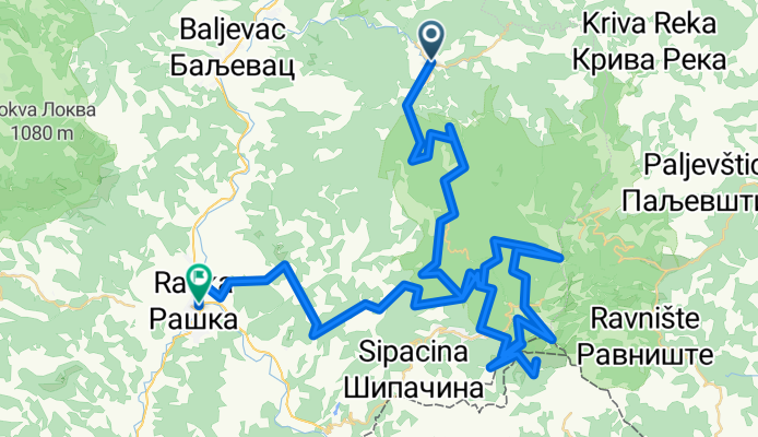
Josanicka Banja - Kopaonik - Raska
A cycling route starting in Raška, Central Serbia, Serbia.
Overview
About this route
- 730,343 h 52 min
- Duration
- 92 km
- Distance
- 2,195 m
- Ascent
- 2,347 m
- Descent
- 0 km/h
- Avg. speed
- ---
- Max. altitude

Continue with Bikemap
Use, edit, or download this cycling route
You would like to ride Josanicka Banja - Kopaonik - Raska or customize it for your own trip? Here is what you can do with this Bikemap route:
Free features
- Save this route as favorite or in collections
- Copy & plan your own version of this route
- Split it into stages to create a multi-day tour
- Sync your route with Garmin or Wahoo
Premium features
Free trial for 3 days, or one-time payment. More about Bikemap Premium.
- Navigate this route on iOS & Android
- Export a GPX / KML file of this route
- Create your custom printout (try it for free)
- Download this route for offline navigation
Discover more Premium features.
Get Bikemap PremiumFrom our community
Other popular routes starting in Raška
 TRI STRANE KOPA 2017 - MALI MARATON
- Distance
- 19.8 km
- Ascent
- 403 m
- Descent
- 406 m
- Location
- Raška, Central Serbia, Serbia
 kopaonik - sa neta
- Distance
- 69.6 km
- Ascent
- 2,040 m
- Descent
- 2,220 m
- Location
- Raška, Central Serbia, Serbia
 Staza "Beli meda"
- Distance
- 20.7 km
- Ascent
- 395 m
- Descent
- 386 m
- Location
- Raška, Central Serbia, Serbia
 TDK I DAN
- Distance
- 115.3 km
- Ascent
- 2,801 m
- Descent
- 2,801 m
- Location
- Raška, Central Serbia, Serbia
 TDK 2.0 II DAN
- Distance
- 82.4 km
- Ascent
- 2,009 m
- Descent
- 2,008 m
- Location
- Raška, Central Serbia, Serbia
 211, Копаоник to Unnamed Road, Kopaonik
- Distance
- 46.3 km
- Ascent
- 1,669 m
- Descent
- 1,659 m
- Location
- Raška, Central Serbia, Serbia
 Bałkany 2015 - Kosovo, Macedonia
- Distance
- 1,147.4 km
- Ascent
- 6,103 m
- Descent
- 6,103 m
- Location
- Raška, Central Serbia, Serbia
 Golija
- Distance
- 319.1 km
- Ascent
- 3,035 m
- Descent
- 4,573 m
- Location
- Raška, Central Serbia, Serbia
Open it in the app