

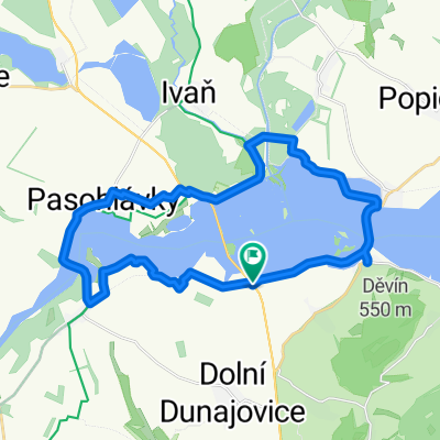
17. Pasohlávky - Nové Město na Moravě (Vysočina aréna)
A cycling route starting in Dolní Dunajovice, South Moravian, Czechia.
Overview
About this route
A more demanding route (from the lowlands to the highlands). From Ivančice, it begins to climb irreversibly.
Here the section E461 Pasohlávky-Pohořelice is prohibited. Therefore, you cannot ride to Pohořelice via Nová Ves. The route goes either through Ivaň (along the Vodní Mlýny II reservoir - left towards Ivaň) to Vranovice - Pohořelice. If the surface is not passable, the route goes via Strachotín and Pouzdřany to Vranovice.
From Pasohlávky, the route passes through Pohořelice, Malešovice, Dolní Kounice, Moravské Bránice, from Hlína to Neslovice (avoid riding through Ivančice unnecessarily), then via Kratochvílka, Babice, Zastávka, past Zbraslav towards Ludíkov, Velká Bíteš (it really passes by the nine large crosses along the road), Ořechov, Křižanov, Pikárec, Bobrůvka, Radešín, Podolí, Radešínská Svratka, Nová Ves near N.M.n.M. all the way to Nové Město n. M.
- -:--
- Duration
- 111.3 km
- Distance
- 891 m
- Ascent
- 425 m
- Descent
- ---
- Avg. speed
- ---
- Max. altitude

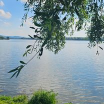
Route photos
\"")
\"")
\"")
\"")
Route quality
Waytypes & surfaces along the route
Waytypes
Road
22.3 km
(20 %)
Quiet road
5.6 km
(5 %)
Surfaces
Paved
32.3 km
(29 %)
Asphalt
32.3 km
(29 %)
Undefined
79 km
(71 %)
Continue with Bikemap
Use, edit, or download this cycling route
You would like to ride 17. Pasohlávky - Nové Město na Moravě (Vysočina aréna) or customize it for your own trip? Here is what you can do with this Bikemap route:
Free features
- Save this route as favorite or in collections
- Copy & plan your own version of this route
- Split it into stages to create a multi-day tour
- Sync your route with Garmin or Wahoo
Premium features
Free trial for 3 days, or one-time payment. More about Bikemap Premium.
- Navigate this route on iOS & Android
- Export a GPX / KML file of this route
- Create your custom printout (try it for free)
- Download this route for offline navigation
Discover more Premium features.
Get Bikemap PremiumFrom our community
Other popular routes starting in Dolní Dunajovice
 Krakau Heimweg 4
- Distance
- 152.5 km
- Ascent
- 6,023 m
- Descent
- 5,600 m
- Location
- Dolní Dunajovice, South Moravian, Czechia
 D.Dunaj.Věst.nádrž-Pavlov-Bavory-Perná-späť
- Distance
- 53.2 km
- Ascent
- 586 m
- Descent
- 655 m
- Location
- Dolní Dunajovice, South Moravian, Czechia
 Okolo Mušova
- Distance
- 26.4 km
- Ascent
- 87 m
- Descent
- 90 m
- Location
- Dolní Dunajovice, South Moravian, Czechia
 Perná - Mikulov - Perná - levý břeh mlýnů -Perná
- Distance
- 46.5 km
- Ascent
- 343 m
- Descent
- 343 m
- Location
- Dolní Dunajovice, South Moravian, Czechia
 Dolni Dunajovice 15.09
- Distance
- 66.9 km
- Ascent
- 538 m
- Descent
- 538 m
- Location
- Dolní Dunajovice, South Moravian, Czechia
 Nikolsburg
- Distance
- 68.7 km
- Ascent
- 390 m
- Descent
- 385 m
- Location
- Dolní Dunajovice, South Moravian, Czechia
 D.Dunajovice-V.nádrž-Mikulov-späť
- Distance
- 52.6 km
- Ascent
- 444 m
- Descent
- 510 m
- Location
- Dolní Dunajovice, South Moravian, Czechia
 17. Pasohlávky - Nové Město na Moravě (Vysočina aréna)
- Distance
- 111.3 km
- Ascent
- 891 m
- Descent
- 425 m
- Location
- Dolní Dunajovice, South Moravian, Czechia
Open it in the app