

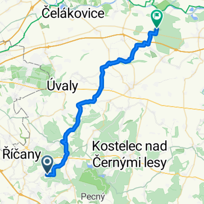
Tehov - Davle
A cycling route starting in Strančice, Central Bohemia, Czechia.
Overview
About this route
Cesta na soutok Sázavy a Vltavy , cesta vlakem do Čerčan 14:41 , z Čerčan zpět domů
- -:--
- Duration
- 30.7 km
- Distance
- 180 m
- Ascent
- 440 m
- Descent
- ---
- Avg. speed
- ---
- Max. altitude

Route quality
Waytypes & surfaces along the route
Waytypes
Track
11.8 km
(38 %)
Road
6.5 km
(21 %)
Surfaces
Paved
5.6 km
(18 %)
Unpaved
12 km
(39 %)
Gravel
10.1 km
(33 %)
Asphalt
3.8 km
(13 %)
Continue with Bikemap
Use, edit, or download this cycling route
You would like to ride Tehov - Davle or customize it for your own trip? Here is what you can do with this Bikemap route:
Free features
- Save this route as favorite or in collections
- Copy & plan your own version of this route
- Sync your route with Garmin or Wahoo
Premium features
Free trial for 3 days, or one-time payment. More about Bikemap Premium.
- Navigate this route on iOS & Android
- Export a GPX / KML file of this route
- Create your custom printout (try it for free)
- Download this route for offline navigation
Discover more Premium features.
Get Bikemap PremiumFrom our community
Other popular routes starting in Strančice
 Tehov - Kersko
- Distance
- 32.1 km
- Ascent
- 103 m
- Descent
- 373 m
- Location
- Strančice, Central Bohemia, Czechia
 Dlouhý okruh na Baštírnu
- Distance
- 46.4 km
- Ascent
- 332 m
- Descent
- 351 m
- Location
- Strančice, Central Bohemia, Czechia
 Malý Hrusický okruh
- Distance
- 26.4 km
- Ascent
- 252 m
- Descent
- 252 m
- Location
- Strančice, Central Bohemia, Czechia
 Tehov - Mikešova cesta
- Distance
- 31.5 km
- Ascent
- 430 m
- Descent
- 431 m
- Location
- Strančice, Central Bohemia, Czechia
 Tehov Struhařov Hrusice Hrušov Mnichovice
- Distance
- 25.6 km
- Ascent
- 237 m
- Descent
- 239 m
- Location
- Strančice, Central Bohemia, Czechia
 Voděradské bučiny - Louňovice - Struhařov 2016
- Distance
- 20.1 km
- Ascent
- 204 m
- Descent
- 204 m
- Location
- Strančice, Central Bohemia, Czechia
 Tehov - Bučiny - Louňovice -Rodinný
- Distance
- 19.8 km
- Ascent
- 173 m
- Descent
- 173 m
- Location
- Strančice, Central Bohemia, Czechia
 8174: Svojšovice – Tehov
- Distance
- 3.2 km
- Ascent
- 40 m
- Descent
- 4 m
- Location
- Strančice, Central Bohemia, Czechia
Open it in the app