

Trieste
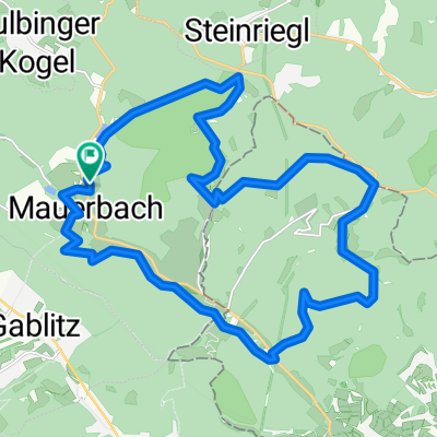
A cycling route starting in Mauerbach, Lower Austria, Austria.
Overview
About this route
Day 1 to Mönichkirchen highest point at 900 meters (100 km)
Day 2 to Graz (120 km)
Day 3 to Velenje, Slovenia (110 km)
Day 4: Vrhnika, outside Ljubljana (90 km)
Day 5: Trieste (70 km)
- -:--
- Duration
- 544.2 km
- Distance
- 2,125 m
- Ascent
- 2,355 m
- Descent
- ---
- Avg. speed
- ---
- Max. altitude
Route quality
Waytypes & surfaces along the route
Waytypes
Quiet road
163.3 km
(30 %)
Road
70.7 km
(13 %)
Surfaces
Paved
380.9 km
(70 %)
Unpaved
21.8 km
(4 %)
Asphalt
380.9 km
(70 %)
Gravel
10.9 km
(2 %)
Route highlights
Points of interest along the route
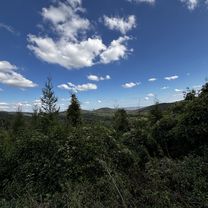
Point of interest after 108.5 km
Sleep first night
Point of interest after 244.3 km
Day 2: Graz (220km)
Point of interest after 364.9 km
Day 3: Velenje, Slovenia (330km)
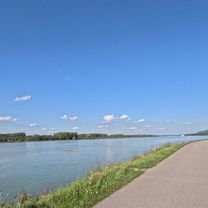
Point of interest after 466.4 km
Day 4: Vrhnika, outside Ljubljana (420km) Outskirts with view over the city.
Point of interest after 537.3 km
Day 5: Trieste (
Continue with Bikemap
Use, edit, or download this cycling route
You would like to ride Trieste or customize it for your own trip? Here is what you can do with this Bikemap route:
Free features
- Save this route as favorite or in collections
- Copy & plan your own version of this route
- Split it into stages to create a multi-day tour
- Sync your route with Garmin or Wahoo
Premium features
Free trial for 3 days, or one-time payment. More about Bikemap Premium.
- Navigate this route on iOS & Android
- Export a GPX / KML file of this route
- Create your custom printout (try it for free)
- Download this route for offline navigation
Discover more Premium features.
Get Bikemap PremiumFrom our community
Other popular routes starting in Mauerbach
 aufi aufn exelberg
- Distance
- 34.3 km
- Ascent
- 429 m
- Descent
- 467 m
- Location
- Mauerbach, Lower Austria, Austria
 Hauptplatz Tulln – Serpentinen von Königstetten Runde von Mauerbach. 🚴♂️🚴
- Distance
- 42.6 km
- Ascent
- 452 m
- Descent
- 452 m
- Location
- Mauerbach, Lower Austria, Austria
 Kahlenberg-Hameau-Strecke
- Distance
- 63.4 km
- Ascent
- 1,129 m
- Descent
- 1,129 m
- Location
- Mauerbach, Lower Austria, Austria
 Tulbinger Kogel
- Distance
- 19.6 km
- Ascent
- 419 m
- Descent
- 419 m
- Location
- Mauerbach, Lower Austria, Austria
 In einer Stunde sollte´s gehen ... irgendwann!
- Distance
- 37.8 km
- Ascent
- 702 m
- Descent
- 711 m
- Location
- Mauerbach, Lower Austria, Austria
 Jägerwirt - Sofienalpe - Steinbach - Scheiblingstein
- Distance
- 23.6 km
- Ascent
- 534 m
- Descent
- 534 m
- Location
- Mauerbach, Lower Austria, Austria
 Sonnberg, St. Andrä-Wördern nach Linzer Straße, Wien
- Distance
- 18.2 km
- Ascent
- 252 m
- Descent
- 496 m
- Location
- Mauerbach, Lower Austria, Austria
 Große Trainingsrunde
- Distance
- 98.1 km
- Ascent
- 1,059 m
- Descent
- 1,059 m
- Location
- Mauerbach, Lower Austria, Austria
Open it in the app