
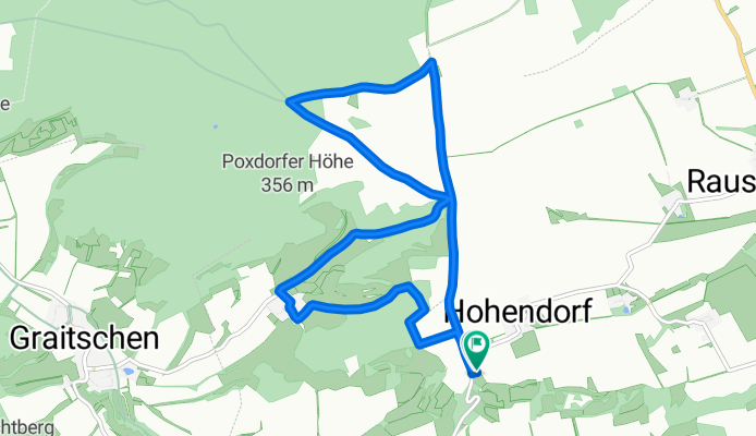
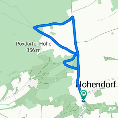
Plantasche-Poxdorf groß
A cycling route starting in Poxdorf, Free State of Thuringia, Germany.
Overview
About this route
- -:--
- Duration
- 9.8 km
- Distance
- 156 m
- Ascent
- 155 m
- Descent
- ---
- Avg. speed
- ---
- Avg. speed

Continue with Bikemap
Use, edit, or download this cycling route
You would like to ride Plantasche-Poxdorf groß or customize it for your own trip? Here is what you can do with this Bikemap route:
Free features
- Save this route as favorite or in collections
- Copy & plan your own version of this route
- Sync your route with Garmin or Wahoo
Premium features
Free trial for 3 days, or one-time payment. More about Bikemap Premium.
- Navigate this route on iOS & Android
- Export a GPX / KML file of this route
- Create your custom printout (try it for free)
- Download this route for offline navigation
Discover more Premium features.
Get Bikemap PremiumFrom our community
Other popular routes starting in Poxdorf
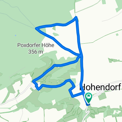
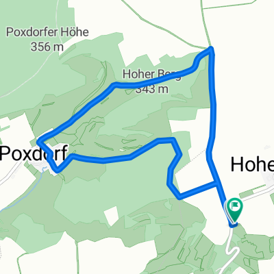 Plantasche-Poxdorf kurz
- Distance
- 5.8 km
- Ascent
- 132 m
- Descent
- 131 m
- Location
- Poxdorf, Free State of Thuringia, Germany
 25.06.2015 20:37
- Distance
- 7.8 km
- Ascent
- 58 m
- Descent
- 57 m
- Location
- Poxdorf, Free State of Thuringia, Germany
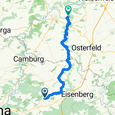 Wethau Radweg
- Distance
- 34.1 km
- Ascent
- 50 m
- Descent
- 282 m
- Location
- Poxdorf, Free State of Thuringia, Germany
 Obstplantasche Bürgel
- Distance
- 7.5 km
- Ascent
- 49 m
- Descent
- 48 m
- Location
- Poxdorf, Free State of Thuringia, Germany
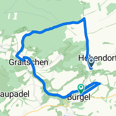 Wilhelmshöhe über Sperbergrund/Graitschen nach Bürgel
- Distance
- 14.3 km
- Ascent
- 126 m
- Descent
- 209 m
- Location
- Poxdorf, Free State of Thuringia, Germany
 Plantasche-Poxdorf groß
- Distance
- 9.8 km
- Ascent
- 156 m
- Descent
- 155 m
- Location
- Poxdorf, Free State of Thuringia, Germany
Open it in the app