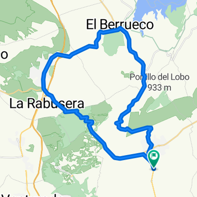
Vuelta por la Sierra Pobre
A cycling route starting in Torrelaguna, Madrid, Spain.
Overview
About this route
Route in the shape of an eight through the Sierra Pobre in Madrid.
- -:--
- Duration
- 135.5 km
- Distance
- 1,490 m
- Ascent
- 1,491 m
- Descent
- ---
- Avg. speed
- ---
- Max. altitude
Route quality
Waytypes & surfaces along the route
Waytypes
Road
101.6 km
(75 %)
Track
8.1 km
(6 %)
Surfaces
Paved
25.7 km
(19 %)
Unpaved
5.4 km
(4 %)
Paved (undefined)
17.6 km
(13 %)
Asphalt
8.1 km
(6 %)
Continue with Bikemap
Use, edit, or download this cycling route
You would like to ride Vuelta por la Sierra Pobre or customize it for your own trip? Here is what you can do with this Bikemap route:
Free features
- Save this route as favorite or in collections
- Copy & plan your own version of this route
- Split it into stages to create a multi-day tour
- Sync your route with Garmin or Wahoo
Premium features
Free trial for 3 days, or one-time payment. More about Bikemap Premium.
- Navigate this route on iOS & Android
- Export a GPX / KML file of this route
- Create your custom printout (try it for free)
- Download this route for offline navigation
Discover more Premium features.
Get Bikemap PremiumFrom our community
Other popular routes starting in Torrelaguna
- Torrelaguna-Atalayas 24.10.15
- Distance
- 38.7 km
- Ascent
- 495 m
- Descent
- 495 m
- Location
- Torrelaguna, Madrid, Spain
- 20140831 Torrelaguna Uceda El Atazar
- Distance
- 41.8 km
- Ascent
- 530 m
- Descent
- 530 m
- Location
- Torrelaguna, Madrid, Spain
- LOS TRES EMBALSES
- Distance
- 85.6 km
- Ascent
- 808 m
- Descent
- 804 m
- Location
- Torrelaguna, Madrid, Spain
- Torrelaguna, el berrueco, robledillo de la jara, paredes, ganduleas, Buitrago, mangiron, llozoyuela, el berrueco, la Cabrera torrelaguna.
- Distance
- 89 km
- Ascent
- 940 m
- Descent
- 939 m
- Location
- Torrelaguna, Madrid, Spain
- Madrid-Gijón-Madrid 2018
- Distance
- 1,217.2 km
- Ascent
- 3,793 m
- Descent
- 3,793 m
- Location
- Torrelaguna, Madrid, Spain
- Vuelta por la Sierra Pobre
- Distance
- 135.5 km
- Ascent
- 1,490 m
- Descent
- 1,491 m
- Location
- Torrelaguna, Madrid, Spain
- 20140904 Torrelaguna La Trampa Valdemanco Venturada
- Distance
- 33.8 km
- Ascent
- 483 m
- Descent
- 484 m
- Location
- Torrelaguna, Madrid, Spain
- Ruta Sierra Norte
- Distance
- 86.3 km
- Ascent
- 821 m
- Descent
- 824 m
- Location
- Torrelaguna, Madrid, Spain
Open it in the app