

2016-07-03 Trun-Oberalppass und zurück
A cycling route starting in Trun, Grisons, Switzerland.
Overview
About this route
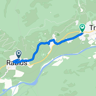
From a parking lot at the western end of Trun (860 m above sea level), it's about 32 km along the main road up to the Oberalppass (2046 m above sea level) at the cantonal border of Graubünden and Uri.
- -:--
- Duration
- 64.6 km
- Distance
- 1,200 m
- Ascent
- 1,199 m
- Descent
- ---
- Avg. speed
- ---
- Max. altitude
Route quality
Waytypes & surfaces along the route
Waytypes
Quiet road
1.3 km
(2 %)
Track
1.3 km
(2 %)
Surfaces
Paved
63.3 km
(98 %)
Unpaved
0.6 km
(1 %)
Asphalt
63.3 km
(98 %)
Unpaved (undefined)
0.6 km
(1 %)
Undefined
0.6 km
(1 %)
Continue with Bikemap
Use, edit, or download this cycling route
You would like to ride 2016-07-03 Trun-Oberalppass und zurück or customize it for your own trip? Here is what you can do with this Bikemap route:
Free features
- Save this route as favorite or in collections
- Copy & plan your own version of this route
- Sync your route with Garmin or Wahoo
Premium features
Free trial for 3 days, or one-time payment. More about Bikemap Premium.
- Navigate this route on iOS & Android
- Export a GPX / KML file of this route
- Create your custom printout (try it for free)
- Download this route for offline navigation
Discover more Premium features.
Get Bikemap PremiumFrom our community
Other popular routes starting in Trun
 disentis - lukmanier - biasca - airolo - gotthard - amdermatt - oberalppass - disentis
- Distance
- 164.5 km
- Ascent
- 3,350 m
- Descent
- 3,199 m
- Location
- Trun, Grisons, Switzerland
 2019 sommer: surselva
- Distance
- 27.7 km
- Ascent
- 483 m
- Descent
- 483 m
- Location
- Trun, Grisons, Switzerland
 18-09-04 Disentis - Chur
- Distance
- 60.7 km
- Ascent
- 444 m
- Descent
- 765 m
- Location
- Trun, Grisons, Switzerland
 Von Somvix bis Truns
- Distance
- 3.2 km
- Ascent
- 40 m
- Descent
- 161 m
- Location
- Trun, Grisons, Switzerland
 2016-07-03 Trun-Oberalppass und zurück
- Distance
- 64.6 km
- Ascent
- 1,200 m
- Descent
- 1,199 m
- Location
- Trun, Grisons, Switzerland
 Eurovelo 15 - Rheinradwag - Trun to Andermatt
- Distance
- 46.1 km
- Ascent
- 1,822 m
- Descent
- 1,245 m
- Location
- Trun, Grisons, Switzerland
 026 - 2014
- Distance
- 137.2 km
- Ascent
- 688 m
- Descent
- 1,301 m
- Location
- Trun, Grisons, Switzerland
 Alpen-X15 Tag 6
- Distance
- 54.8 km
- Ascent
- 1,517 m
- Descent
- 1,218 m
- Location
- Trun, Grisons, Switzerland
Open it in the app