R4K PC2012 Dag 3 groep B
- 76.7 km
- 1,736 m
- 1,736 m
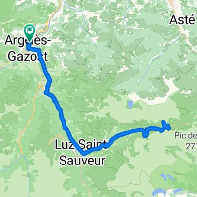
- Argelès-Gazost, Occitanie, France
A cycling route starting in Argelès-Gazost, Occitanie, France.
Overview
Average grade: 4.1 %
Length: 30.1 km
Height start: 463 m
Height top: 1710 m
Ascent: 1247 m
Maximum: 9 %
World difficulty rating: 1703
created this 9 years ago
Route quality
Track
1.2 km
(4 %)
Quiet road
0.9 km
(3 %)
Undefined
26.8 km
(93 %)
Paved
26.8 km
(93 %)
Unpaved
1.4 km
(5 %)
Asphalt
26.8 km
(93 %)
Ground
1.2 km
(4 %)
Continue with Bikemap
You would like to ride Col de l'Aubisque - Via Col de Soulor (EPIC CLIMBS) or customize it for your own trip? Here is what you can do with this Bikemap route:
Free trial for 3 days, or one-time payment. More about Bikemap Premium.
Discover more Premium features.
Get Bikemap PremiumFrom our community
Open it in the app