

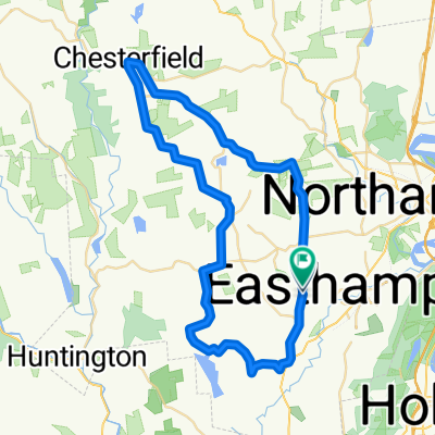
Shortened Mini Fundo 55k
A cycling route starting in Easthampton, Massachusetts, United States of America.
Overview
About this route
- -:--
- Duration
- 55 km
- Distance
- 705 m
- Ascent
- 694 m
- Descent
- ---
- Avg. speed
- ---
- Max. altitude
Route quality
Waytypes & surfaces along the route
Waytypes
Busy road
32.1 km
(58 %)
Quiet road
22 km
(40 %)
Surfaces
Paved
5.1 km
(9 %)
Unpaved
8.3 km
(15 %)
Unpaved (undefined)
8.3 km
(15 %)
Asphalt
3.5 km
(6 %)
Continue with Bikemap
Use, edit, or download this cycling route
You would like to ride Shortened Mini Fundo 55k or customize it for your own trip? Here is what you can do with this Bikemap route:
Free features
- Save this route as favorite or in collections
- Copy & plan your own version of this route
- Sync your route with Garmin or Wahoo
Premium features
Free trial for 3 days, or one-time payment. More about Bikemap Premium.
- Navigate this route on iOS & Android
- Export a GPX / KML file of this route
- Create your custom printout (try it for free)
- Download this route for offline navigation
Discover more Premium features.
Get Bikemap PremiumFrom our community
Other popular routes starting in Easthampton
 manhan to uya
- Distance
- 10.1 km
- Ascent
- 22 m
- Descent
- 46 m
- Location
- Easthampton, Massachusetts, United States of America
 Crooked ledges North Island
- Distance
- 71.5 km
- Ascent
- 1,423 m
- Descent
- 1,426 m
- Location
- Easthampton, Massachusetts, United States of America
 125 Reservation Rd, Holyoke to 37 Portland St, Holyoke
- Distance
- 11.8 km
- Ascent
- 183 m
- Descent
- 236 m
- Location
- Easthampton, Massachusetts, United States of America
 Skyline Trail from NOHO
- Distance
- 107.7 km
- Ascent
- 1,251 m
- Descent
- 1,246 m
- Location
- Easthampton, Massachusetts, United States of America
 Mt Tom loop
- Distance
- 12.9 km
- Ascent
- 191 m
- Descent
- 191 m
- Location
- Easthampton, Massachusetts, United States of America
 Peace Pagoda & River Farmland - Easthampton
- Distance
- 79.9 km
- Ascent
- 342 m
- Descent
- 341 m
- Location
- Easthampton, Massachusetts, United States of America
 Shortened Mini Fundo 55k
- Distance
- 55 km
- Ascent
- 705 m
- Descent
- 694 m
- Location
- Easthampton, Massachusetts, United States of America
 Holly Circle 36, Easthampton to South Pleasant Street 129, Amherst
- Distance
- 23.8 km
- Ascent
- 194 m
- Descent
- 156 m
- Location
- Easthampton, Massachusetts, United States of America
Open it in the app