
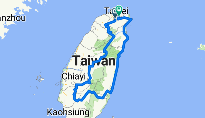
三橫一豎+花東海岸線
A cycling route starting in Taipei, Taipei, Taiwan.
Overview
About this route
Started in mid-August 2008, completed in 13 days. Includes climbing Yushan... An extremely challenging route ^^
- -:--
- Duration
- 1,118.3 km
- Distance
- 8,871 m
- Ascent
- 8,871 m
- Descent
- ---
- Avg. speed
- ---
- Max. altitude
Continue with Bikemap
Use, edit, or download this cycling route
You would like to ride 三橫一豎+花東海岸線 or customize it for your own trip? Here is what you can do with this Bikemap route:
Free features
- Save this route as favorite or in collections
- Copy & plan your own version of this route
- Split it into stages to create a multi-day tour
- Sync your route with Garmin or Wahoo
Premium features
Free trial for 3 days, or one-time payment. More about Bikemap Premium.
- Navigate this route on iOS & Android
- Export a GPX / KML file of this route
- Create your custom printout (try it for free)
- Download this route for offline navigation
Discover more Premium features.
Get Bikemap PremiumFrom our community
Other popular routes starting in Taipei
 復興南路穿南港南深路轉景美溪回
- Distance
- 44.9 km
- Ascent
- 302 m
- Descent
- 304 m
- Location
- Taipei, Taipei, Taiwan
 Sep.14,10-環大台北練習
- Distance
- 168.3 km
- Ascent
- 703 m
- Descent
- 703 m
- Location
- Taipei, Taipei, Taiwan
 中社爬坡路徑
- Distance
- 4.3 km
- Ascent
- 294 m
- Descent
- 54 m
- Location
- Taipei, Taipei, Taiwan
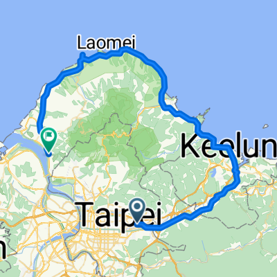 20081011 北海岸1
- Distance
- 80.8 km
- Ascent
- 392 m
- Descent
- 383 m
- Location
- Taipei, Taipei, Taiwan
 信義-崇德街-阿柔洋-碎心坡-草湳-貓空站-政大-萬芳社區-信義(O型)
- Distance
- 35.5 km
- Ascent
- 1,399 m
- Descent
- 1,376 m
- Location
- Taipei, Taipei, Taiwan
 腳踏車環島 2011/01/20~2011/01/31
- Distance
- 1,239.7 km
- Ascent
- 1,590 m
- Descent
- 1,590 m
- Location
- Taipei, Taipei, Taiwan
 P字道
P字道- Distance
- 76.1 km
- Ascent
- 2,461 m
- Descent
- 2,021 m
- Location
- Taipei, Taipei, Taiwan
 永和-淡水來回
- Distance
- 71.1 km
- Ascent
- 90 m
- Descent
- 81 m
- Location
- Taipei, Taipei, Taiwan
Open it in the app