

Hinterstoder-Runde
A cycling route starting in Rossleithen, Upper Austria, Austria.
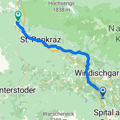
Overview
About this route
Schöne aber schwere Route, meißt Asphaltbelag nur zum Schiederweiher und zur Bauschlagerreith Wanderweg. Langer Anstieg nach Vorderstoder und lange Abfahrt zum Bhf Hinterstoder.
- -:--
- Duration
- 43.4 km
- Distance
- 582 m
- Ascent
- 578 m
- Descent
- ---
- Avg. speed
- ---
- Max. altitude

Route quality
Waytypes & surfaces along the route
Waytypes
Busy road
18.7 km
(43 %)
Quiet road
10 km
(23 %)
Surfaces
Paved
22.5 km
(52 %)
Unpaved
9.1 km
(21 %)
Asphalt
21.3 km
(49 %)
Gravel
4.7 km
(11 %)
Continue with Bikemap
Use, edit, or download this cycling route
You would like to ride Hinterstoder-Runde or customize it for your own trip? Here is what you can do with this Bikemap route:
Free features
- Save this route as favorite or in collections
- Copy & plan your own version of this route
- Sync your route with Garmin or Wahoo
Premium features
Free trial for 3 days, or one-time payment. More about Bikemap Premium.
- Navigate this route on iOS & Android
- Export a GPX / KML file of this route
- Create your custom printout (try it for free)
- Download this route for offline navigation
Discover more Premium features.
Get Bikemap PremiumFrom our community
Other popular routes starting in Rossleithen
 Imitzberg
- Distance
- 35.6 km
- Ascent
- 841 m
- Descent
- 841 m
- Location
- Rossleithen, Upper Austria, Austria
 Von Spital am Pyhrn bis Wels
- Distance
- 22.2 km
- Ascent
- 645 m
- Descent
- 765 m
- Location
- Rossleithen, Upper Austria, Austria
 Langfirst
- Distance
- 27.6 km
- Ascent
- 884 m
- Descent
- 821 m
- Location
- Rossleithen, Upper Austria, Austria
 Hinterstoder - Hütterer Höss
- Distance
- 23.1 km
- Ascent
- 267 m
- Descent
- 1,086 m
- Location
- Rossleithen, Upper Austria, Austria
 Enghagen - Gowidlalm - Schwarzkogel - Veichteltal
- Distance
- 66.7 km
- Ascent
- 2,386 m
- Descent
- 2,441 m
- Location
- Rossleithen, Upper Austria, Austria
 Windischgarsten első napi túra (R9, MTB4)
- Distance
- 103.6 km
- Ascent
- 832 m
- Descent
- 1,008 m
- Location
- Rossleithen, Upper Austria, Austria
 2023_06_07_ Windischgarsten-Hengspassrunde
- Distance
- 33.7 km
- Ascent
- 942 m
- Descent
- 941 m
- Location
- Rossleithen, Upper Austria, Austria
 Hinterstoder- Vorderstoder
- Distance
- 30 km
- Ascent
- 988 m
- Descent
- 988 m
- Location
- Rossleithen, Upper Austria, Austria
Open it in the app