

Embalses del Portillo y San Clemente
A cycling route starting in Castril, Andalusia, Spain.
Overview
About this route
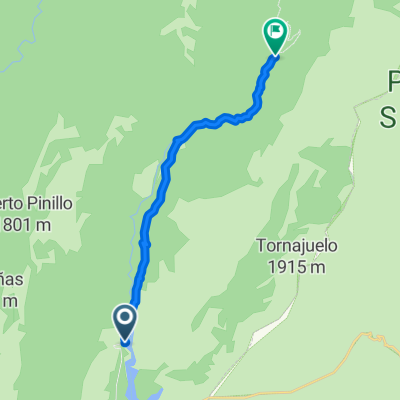
Route from the Embalse del Portillo to the Embalse de San Clemente passing through Huéscar, Castril, Virgen de Fátima, Duda, and Teba.
- -:--
- Duration
- 62.5 km
- Distance
- 655 m
- Ascent
- 648 m
- Descent
- ---
- Avg. speed
- ---
- Max. altitude

Continue with Bikemap
Use, edit, or download this cycling route
You would like to ride Embalses del Portillo y San Clemente or customize it for your own trip? Here is what you can do with this Bikemap route:
Free features
- Save this route as favorite or in collections
- Copy & plan your own version of this route
- Sync your route with Garmin or Wahoo
Premium features
Free trial for 3 days, or one-time payment. More about Bikemap Premium.
- Navigate this route on iOS & Android
- Export a GPX / KML file of this route
- Create your custom printout (try it for free)
- Download this route for offline navigation
Discover more Premium features.
Get Bikemap PremiumFrom our community
Other popular routes starting in Castril
 Rambla seca La matea
- Distance
- 28.5 km
- Ascent
- 250 m
- Descent
- 522 m
- Location
- Castril, Andalusia, Spain
 Sierras del Pozo y Segura
- Distance
- 58.8 km
- Ascent
- 1,979 m
- Descent
- 1,979 m
- Location
- Castril, Andalusia, Spain
 De Camino de Castril a Santiago de la Espada a Camino de Castril a Santiago de la Espada
- Distance
- 17.5 km
- Ascent
- 391 m
- Descent
- 385 m
- Location
- Castril, Andalusia, Spain
 Embalses del Portillo y San Clemente
- Distance
- 62.5 km
- Ascent
- 655 m
- Descent
- 648 m
- Location
- Castril, Andalusia, Spain
 Castril-La Matea (Santiago-Pontones)
- Distance
- 64.9 km
- Ascent
- 1,397 m
- Descent
- 979 m
- Location
- Castril, Andalusia, Spain
 Cortijo del Molinillo - Casa Forestal del Barranco del Guadalentin
- Distance
- 12.9 km
- Ascent
- 456 m
- Descent
- 207 m
- Location
- Castril, Andalusia, Spain
 Bolera - Campos - Las Canalejas - Tranco - Hornos
- Distance
- 92.4 km
- Ascent
- 2,320 m
- Descent
- 2,461 m
- Location
- Castril, Andalusia, Spain
 Bolera - Bolera por Guadalentín túneles, Roblehondo, Los Calarejos, Nava de San Pedro.
- Distance
- 70.3 km
- Ascent
- 2,839 m
- Descent
- 2,844 m
- Location
- Castril, Andalusia, Spain
Open it in the app