

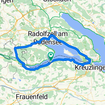
Schienerberg und Seerücken
A cycling route starting in Gaienhofen, Baden-Wurttemberg, Germany.
Overview
About this route
Ascent and descent with great views of the lake, Hegau, pre-Alpine region, Säntis and Churfirsten
- -:--
- Duration
- 86.1 km
- Distance
- 1,447 m
- Ascent
- 1,341 m
- Descent
- ---
- Avg. speed
- 732 m
- Max. altitude
Route quality
Waytypes & surfaces along the route
Waytypes
Road
28.4 km
(33 %)
Quiet road
12.1 km
(14 %)
Surfaces
Paved
68 km
(79 %)
Unpaved
3.4 km
(4 %)
Asphalt
68 km
(79 %)
Gravel
2.6 km
(3 %)
Continue with Bikemap
Use, edit, or download this cycling route
You would like to ride Schienerberg und Seerücken or customize it for your own trip? Here is what you can do with this Bikemap route:
Free features
- Save this route as favorite or in collections
- Copy & plan your own version of this route
- Split it into stages to create a multi-day tour
- Sync your route with Garmin or Wahoo
Premium features
Free trial for 3 days, or one-time payment. More about Bikemap Premium.
- Navigate this route on iOS & Android
- Export a GPX / KML file of this route
- Create your custom printout (try it for free)
- Download this route for offline navigation
Discover more Premium features.
Get Bikemap PremiumFrom our community
Other popular routes starting in Gaienhofen
 4 Friends
- Distance
- 62.9 km
- Ascent
- 304 m
- Descent
- 257 m
- Location
- Gaienhofen, Baden-Wurttemberg, Germany
 Schienerberg und Seerücken
- Distance
- 86.1 km
- Ascent
- 1,447 m
- Descent
- 1,341 m
- Location
- Gaienhofen, Baden-Wurttemberg, Germany
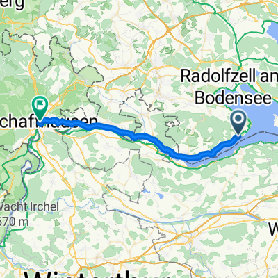
 7 Von Gaienhofen bis Feuerthalen
- Distance
- 32.2 km
- Ascent
- 338 m
- Descent
- 313 m
- Location
- Gaienhofen, Baden-Wurttemberg, Germany
 Route nach Obergass
- Distance
- 12.8 km
- Ascent
- 137 m
- Descent
- 131 m
- Location
- Gaienhofen, Baden-Wurttemberg, Germany
 Bodensee 72
- Distance
- 71.2 km
- Ascent
- 246 m
- Descent
- 246 m
- Location
- Gaienhofen, Baden-Wurttemberg, Germany
 Hauptstraße, Gaienhofen nach Steigstrasse, Schaffhausen
- Distance
- 32.2 km
- Ascent
- 327 m
- Descent
- 293 m
- Location
- Gaienhofen, Baden-Wurttemberg, Germany
 Frauenfelderstrasse, Steckborn nach Frauenfelderstrasse, Steckborn
- Distance
- 69.7 km
- Ascent
- 443 m
- Descent
- 444 m
- Location
- Gaienhofen, Baden-Wurttemberg, Germany
 Höri 2
- Distance
- 31.5 km
- Ascent
- 496 m
- Descent
- 512 m
- Location
- Gaienhofen, Baden-Wurttemberg, Germany
Open it in the app