

Chichibu-Tomioka 2days
A cycling route starting in Yorii, Saitama, Japan.
Overview
About this route
1日目
(黒保根から赤城駅まで走行:約10km・・・早朝で電車がないため)
赤城駅~寄居駅間を輪行(東武線・秩父鉄道)
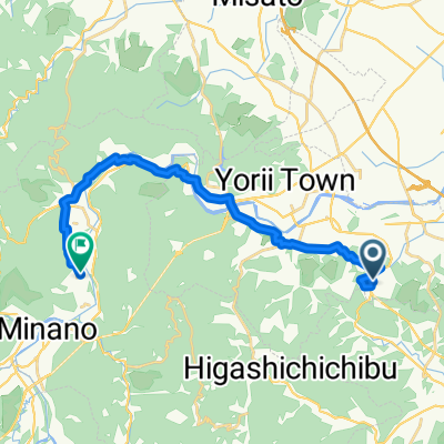
寄居駅からキャンプ場まで走行:約63km
宿泊:中津川村キャンプ場
温泉:キャンプ場内
2日目
キャンプ場から上州新屋駅まで走行:約81km
上州新屋駅から水沼駅まで輪行(上信電鉄・JR線)
温泉:かんらの湯(上州新屋駅近く)
- -:--
- Duration
- 144.4 km
- Distance
- 1,760 m
- Ascent
- 1,728 m
- Descent
- ---
- Avg. speed
- ---
- Max. altitude
Route highlights
Points of interest along the route
Accommodation after 65.7 km
Nakatsugawa-Village Campsite
Continue with Bikemap
Use, edit, or download this cycling route
You would like to ride Chichibu-Tomioka 2days or customize it for your own trip? Here is what you can do with this Bikemap route:
Free features
- Save this route as favorite or in collections
- Copy & plan your own version of this route
- Split it into stages to create a multi-day tour
- Sync your route with Garmin or Wahoo
Premium features
Free trial for 3 days, or one-time payment. More about Bikemap Premium.
- Navigate this route on iOS & Android
- Export a GPX / KML file of this route
- Create your custom printout (try it for free)
- Download this route for offline navigation
Discover more Premium features.
Get Bikemap PremiumFrom our community
Other popular routes starting in Yorii
 Tour de Japon 6th Stage Yorii - Takasaki
- Distance
- 158.9 km
- Ascent
- 1,425 m
- Descent
- 1,431 m
- Location
- Yorii, Saitama, Japan
 長瀞, 長瀞町へ長瀞, 長瀞町
- Distance
- 1.6 km
- Ascent
- 17 m
- Descent
- 20 m
- Location
- Yorii, Saitama, Japan
 Chichibu-Tomioka 2days
- Distance
- 144.4 km
- Ascent
- 1,760 m
- Descent
- 1,728 m
- Location
- Yorii, Saitama, Japan
 75 熊谷南部荒川ふれあいルート
- Distance
- 46.3 km
- Ascent
- 264 m
- Descent
- 265 m
- Location
- Yorii, Saitama, Japan
 Tomita, Yorii, Osato-Gun to 538-2, Omaeda, Fukaya
- Distance
- 6.8 km
- Ascent
- 67 m
- Descent
- 121 m
- Location
- Yorii, Saitama, Japan
 99 ぐるっと長瀞周回ルート
- Distance
- 18.7 km
- Ascent
- 254 m
- Descent
- 266 m
- Location
- Yorii, Saitama, Japan
 Tomita, Yorii, Osato-Gun to 538-2, Omaeda, Fukaya
- Distance
- 6.8 km
- Ascent
- 68 m
- Descent
- 124 m
- Location
- Yorii, Saitama, Japan
 Tomita, Yorii, Osato-Gun to 526-3, Nagatoro, Nagatoro, Chichibu-Gun
- Distance
- 19.3 km
- Ascent
- 261 m
- Descent
- 255 m
- Location
- Yorii, Saitama, Japan
Open it in the app