

2016.07.10_Gruppe 2_Forst Sinsbuch-Obereichet-Kiesgrube
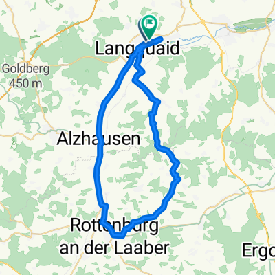
A cycling route starting in Langquaid, Bavaria, Germany.
Overview
About this route
Langquaid School
Market Pond
English Greeting
Sinsbuch Forest
Rohrbuckel Descent
St. Englmar
Hagenach
Tannenhof
Leitenhausen
Sandsbach
Obereichet
Gravel Pit
Appersdorf
Langquaid School
- -:--
- Duration
- 22.9 km
- Distance
- 220 m
- Ascent
- 219 m
- Descent
- ---
- Avg. speed
- ---
- Max. altitude

Route quality
Waytypes & surfaces along the route
Waytypes
Track
16.7 km
(73 %)
Quiet road
3.4 km
(15 %)
Surfaces
Paved
3.9 km
(17 %)
Unpaved
13.7 km
(60 %)
Ground
6.9 km
(30 %)
Gravel
3.7 km
(16 %)
Continue with Bikemap
Use, edit, or download this cycling route
You would like to ride 2016.07.10_Gruppe 2_Forst Sinsbuch-Obereichet-Kiesgrube or customize it for your own trip? Here is what you can do with this Bikemap route:
Free features
- Save this route as favorite or in collections
- Copy & plan your own version of this route
- Sync your route with Garmin or Wahoo
Premium features
Free trial for 3 days, or one-time payment. More about Bikemap Premium.
- Navigate this route on iOS & Android
- Export a GPX / KML file of this route
- Create your custom printout (try it for free)
- Download this route for offline navigation
Discover more Premium features.
Get Bikemap PremiumFrom our community
Other popular routes starting in Langquaid
 20170414_Karfreitagsrunde zum Frauenhäusl mit Annemarie
- Distance
- 52 km
- Ascent
- 434 m
- Descent
- 434 m
- Location
- Langquaid, Bavaria, Germany
 2018.05.02_MTB-Herren_Obermassing
- Distance
- 42 km
- Ascent
- 428 m
- Descent
- 428 m
- Location
- Langquaid, Bavaria, Germany
 Winkl-Oberhaselbach-Mannsdorf
- Distance
- 42.3 km
- Ascent
- 502 m
- Descent
- 500 m
- Location
- Langquaid, Bavaria, Germany
 2016.05.12_Langquaid-14-Türmeblick-Altbach-Kiesgrube Leierndorf
- Distance
- 28.9 km
- Ascent
- 336 m
- Descent
- 340 m
- Location
- Langquaid, Bavaria, Germany
 2020-08-08_Kanonenrohr
- Distance
- 30.2 km
- Ascent
- 343 m
- Descent
- 342 m
- Location
- Langquaid, Bavaria, Germany
 Frauenbründl-Saalhaupt
- Distance
- 29.6 km
- Ascent
- 411 m
- Descent
- 409 m
- Location
- Langquaid, Bavaria, Germany
 2016.07.10_Gruppe 2_Forst Sinsbuch-Obereichet-Kiesgrube
- Distance
- 22.9 km
- Ascent
- 220 m
- Descent
- 219 m
- Location
- Langquaid, Bavaria, Germany
 ForstnerWirt Runde MTB
- Distance
- 38.5 km
- Ascent
- 314 m
- Descent
- 315 m
- Location
- Langquaid, Bavaria, Germany
Open it in the app