Südost nach Nordost
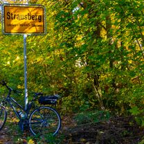
A cycling route starting in Johannisthal, Land Berlin, Germany.
Overview
About this route
very nice road in Köpenick (paved cycle road through the wood without any car traffic)
bad cycleway on Fürstenwalder Str. (roots damaged the cycleway)
cobblestone road in down town of Altlandsberg (better to go on pavement)
bad asphalt on the road between Löhme and Börnicke
- -:--
- Duration
- 71.6 km
- Distance
- 113 m
- Ascent
- 89 m
- Descent
- ---
- Avg. speed
- ---
- Avg. speed
Route quality
Waytypes & surfaces along the route
Waytypes
Busy road
26.1 km
(37 %)
Path
14.9 km
(21 %)
Surfaces
Paved
69.8 km
(97 %)
Unpaved
0 km
(<1 %)
Asphalt
51.8 km
(72 %)
Paving stones
16.7 km
(23 %)
Continue with Bikemap
Use, edit, or download this cycling route
You would like to ride Südost nach Nordost or customize it for your own trip? Here is what you can do with this Bikemap route:
Free features
- Save this route as favorite or in collections
- Copy & plan your own version of this route
- Sync your route with Garmin or Wahoo
Premium features
Free trial for 3 days, or one-time payment. More about Bikemap Premium.
- Navigate this route on iOS & Android
- Export a GPX / KML file of this route
- Create your custom printout (try it for free)
- Download this route for offline navigation
Discover more Premium features.
Get Bikemap PremiumFrom our community
Other popular routes starting in Johannisthal
- 2020-05-01 mit Blattlaus
- Distance
- 11.5 km
- Ascent
- 9 m
- Descent
- 8 m
- Location
- Johannisthal, Land Berlin, Germany
- Südost nach Nordost
- Distance
- 71.6 km
- Ascent
- 113 m
- Descent
- 89 m
- Location
- Johannisthal, Land Berlin, Germany
- Adlershof - Müggelberg
- Distance
- 33.1 km
- Ascent
- 100 m
- Descent
- 97 m
- Location
- Johannisthal, Land Berlin, Germany
- Heimrunde Berlin Ost
- Distance
- 101.4 km
- Ascent
- 159 m
- Descent
- 163 m
- Location
- Johannisthal, Land Berlin, Germany
- Von Johannisthal nach Straussberg
- Distance
- 36 km
- Ascent
- 183 m
- Descent
- 170 m
- Location
- Johannisthal, Land Berlin, Germany
- Feierabend / Rund um BBI
- Distance
- 52.1 km
- Ascent
- 88 m
- Descent
- 91 m
- Location
- Johannisthal, Land Berlin, Germany
- Leichte Runde
- Distance
- 53.3 km
- Ascent
- 97 m
- Descent
- 92 m
- Location
- Johannisthal, Land Berlin, Germany
- Nach Bad Freienwalde
- Distance
- 70.9 km
- Ascent
- 283 m
- Descent
- 297 m
- Location
- Johannisthal, Land Berlin, Germany
Open it in the app