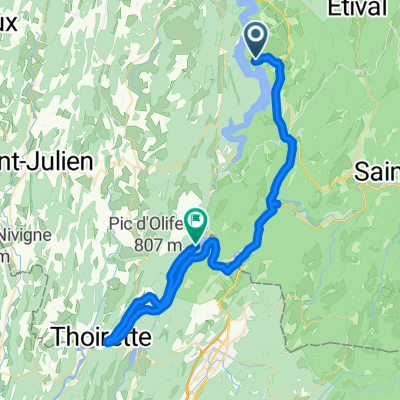
Tour de France 2016 - Stage 16
A cycling route starting in Moirans-en-Montagne, Bourgogne-Franche-Comté, France.
Overview
About this route
Monday, July 18th
Moirans-en-Montagne / Berne
209 km
- -:--
- Duration
- 215.5 km
- Distance
- 1,237 m
- Ascent
- 1,320 m
- Descent
- ---
- Avg. speed
- ---
- Max. altitude
Route highlights
Points of interest along the route
Point of interest after 174.4 km
Sprint
Point of interest after 191.1 km
4 Kt. - Côte de Mühleberg (552 m)
Continue with Bikemap
Use, edit, or download this cycling route
You would like to ride Tour de France 2016 - Stage 16 or customize it for your own trip? Here is what you can do with this Bikemap route:
Free features
- Save this route as favorite or in collections
- Copy & plan your own version of this route
- Split it into stages to create a multi-day tour
- Sync your route with Garmin or Wahoo
Premium features
Free trial for 3 days, or one-time payment. More about Bikemap Premium.
- Navigate this route on iOS & Android
- Export a GPX / KML file of this route
- Create your custom printout (try it for free)
- Download this route for offline navigation
Discover more Premium features.
Get Bikemap PremiumFrom our community
Other popular routes starting in Moirans-en-Montagne
 2017-10-15 / Borcel, c'est beau le Jura !
- Distance
- 110.2 km
- Ascent
- 1,871 m
- Descent
- 1,895 m
- Location
- Moirans-en-Montagne, Bourgogne-Franche-Comté, France
 Tour de France 2016 - Stage 16
- Distance
- 215.5 km
- Ascent
- 1,237 m
- Descent
- 1,320 m
- Location
- Moirans-en-Montagne, Bourgogne-Franche-Comté, France
 week end lac vouglan
- Distance
- 81.2 km
- Ascent
- 871 m
- Descent
- 875 m
- Location
- Moirans-en-Montagne, Bourgogne-Franche-Comté, France
 Balade sans difficulté à pèartir de Maisod
- Distance
- 56.4 km
- Ascent
- 694 m
- Descent
- 696 m
- Location
- Moirans-en-Montagne, Bourgogne-Franche-Comté, France
 vacance ete 2016 jura avec crete de laneige
- Distance
- 223 km
- Ascent
- 2,181 m
- Descent
- 2,149 m
- Location
- Moirans-en-Montagne, Bourgogne-Franche-Comté, France
 Etape 6 - Maisod à Condes (lac de Coiselet) - 51,6km 530D+
- Distance
- 51.6 km
- Ascent
- 397 m
- Descent
- 625 m
- Location
- Moirans-en-Montagne, Bourgogne-Franche-Comté, France
 moirans en montagne- maisod
- Distance
- 17.1 km
- Ascent
- 1,257 m
- Descent
- 1,255 m
- Location
- Moirans-en-Montagne, Bourgogne-Franche-Comté, France
 Cascades du Herisson
- Distance
- 100 km
- Ascent
- 1,066 m
- Descent
- 1,063 m
- Location
- Moirans-en-Montagne, Bourgogne-Franche-Comté, France
Open it in the app

