
Lengthy ride through Podu Dâmboviței
A cycling route starting in Rucăr, Arges, Romania.
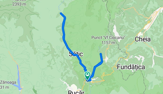
Overview
About this route
- 5 h 1 min
- Duration
- 40.7 km
- Distance
- 587 m
- Ascent
- 587 m
- Descent
- 8.1 km/h
- Avg. speed
- ---
- Max. altitude

Route quality
Waytypes & surfaces along the route
Waytypes
Road
26 km
(64 %)
Quiet road
4.5 km
(11 %)
Undefined
10.2 km
(25 %)
Surfaces
Paved
37 km
(91 %)
Unpaved
3.7 km
(9 %)
Asphalt
37 km
(91 %)
Gravel
3.7 km
(9 %)
Route highlights
Points of interest along the route

Point of interest after 26.3 km
Podul Dambovitei
Continue with Bikemap
Use, edit, or download this cycling route
You would like to ride Lengthy ride through Podu Dâmboviței or customize it for your own trip? Here is what you can do with this Bikemap route:
Free features
- Save this route as favorite or in collections
- Copy & plan your own version of this route
- Sync your route with Garmin or Wahoo
Premium features
Free trial for 3 days, or one-time payment. More about Bikemap Premium.
- Navigate this route on iOS & Android
- Export a GPX / KML file of this route
- Create your custom printout (try it for free)
- Download this route for offline navigation
Discover more Premium features.
Get Bikemap PremiumFrom our community
Other popular routes starting in Rucăr
 SPRAVEL - Podu Dîmboviței-Dâmbovicioara-Ciocanu-Sirnea-Fundata-Podu Dâmboviței
- Distance
- 32.1 km
- Ascent
- 763 m
- Descent
- 763 m
- Location
- Rucăr, Arges, Romania
 Podul Dambovitei, Fundatica, Sirnea, Ciocanu, Dambovicioara
- Distance
- 40.7 km
- Ascent
- 849 m
- Descent
- 849 m
- Location
- Rucăr, Arges, Romania
 Podu Dambovitei - Oticu
- Distance
- 44.5 km
- Ascent
- 1,284 m
- Descent
- 273 m
- Location
- Rucăr, Arges, Romania
 CAB. VOINA spre Cuca
- Distance
- 3.8 km
- Ascent
- 392 m
- Descent
- 101 m
- Location
- Rucăr, Arges, Romania
 Podu Dâmboviței Ciocanu Șirnea La Table
- Distance
- 32.2 km
- Ascent
- 878 m
- Descent
- 878 m
- Location
- Rucăr, Arges, Romania
 Dambovicioara
- Distance
- 31.5 km
- Ascent
- 676 m
- Descent
- 643 m
- Location
- Rucăr, Arges, Romania
 Lengthy ride through Podu Dâmboviței
- Distance
- 40.7 km
- Ascent
- 587 m
- Descent
- 587 m
- Location
- Rucăr, Arges, Romania
 Route RO > Iezerul Mic
- Distance
- 114.5 km
- Ascent
- 2,416 m
- Descent
- 2,417 m
- Location
- Rucăr, Arges, Romania
Open it in the app