- 2.2 km
- 0 m
- 0 m
- Märkisches Viertel, State of Berlin, Germany
Reinickendorf-Potsdam-Hennigsdorf...
A cycling route starting in Märkisches Viertel, State of Berlin, Germany.
Overview
About this route
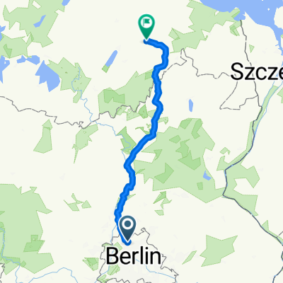
The route leads from Reinickendorf via the Havelchaussee and Schäferberg to Potsdam. From there, it returns to Reinickendorf via Hennigsdorf. The route is mostly paved. However, around the Olympic Stadium, cobblestones are encountered. The Havelchaussee and Schäferberg are partly quite steep. From Potsdam to Hennigsdorf, there is a well-developed bike path that should be used.
- -:--
- Duration
- 103.6 km
- Distance
- 423 m
- Ascent
- 429 m
- Descent
- ---
- Avg. speed
- 95 m
- Max. altitude
created this 16 years ago
Route quality
Waytypes & surfaces along the route
Waytypes
Path
21.7 km
(21 %)
Road
17.6 km
(17 %)
Surfaces
Paved
84.9 km
(82 %)
Unpaved
1 km
(1 %)
Asphalt
83.9 km
(81 %)
Concrete
1 km
(1 %)
Continue with Bikemap
Use, edit, or download this cycling route
You would like to ride Reinickendorf-Potsdam-Hennigsdorf... or customize it for your own trip? Here is what you can do with this Bikemap route:
Free features
- Save this route as favorite or in collections
- Copy & plan your own version of this route
- Split it into stages to create a multi-day tour
- Sync your route with Garmin or Wahoo
Premium features
Free trial for 3 days, or one-time payment. More about Bikemap Premium.
- Navigate this route on iOS & Android
- Export a GPX / KML file of this route
- Create your custom printout (try it for free)
- Download this route for offline navigation
Discover more Premium features.
Get Bikemap PremiumFrom our community
Other popular routes starting in Märkisches Viertel
- Senftenberger Ring 8, Berlin nach Senftenberger Ring 10, Berlin
- mittenmang, reinickendorf-schöneberg
- 18.1 km
- 29 m
- 37 m
- Märkisches Viertel, State of Berlin, Germany
- Bagger- & Köppchensee
- 16.3 km
- 61 m
- 61 m
- Märkisches Viertel, State of Berlin, Germany
- Eichhorster Weg 46–48, Berlin nach Eichhorster Straße 24, Friedland
- 146.9 km
- 732 m
- 711 m
- Märkisches Viertel, State of Berlin, Germany
- Mauerweg / Tegeler Fließ
- 10.9 km
- 46 m
- 54 m
- Märkisches Viertel, State of Berlin, Germany
- hausrunde, glienicke, schildow,schönfließ
- 23.2 km
- 59 m
- 59 m
- Märkisches Viertel, State of Berlin, Germany
- Rund um Lübars
- 12.6 km
- 90 m
- 87 m
- Märkisches Viertel, State of Berlin, Germany
- Senftenberger Ring 10, Berlin nach Senftenberger Ring 10, Berlin
- 5 km
- 26 m
- 27 m
- Märkisches Viertel, State of Berlin, Germany
Open it in the app


