

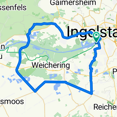
Schambachtalbahn-Radweg
A cycling route starting in Ingolstadt, Bavaria, Germany.
Overview
About this route
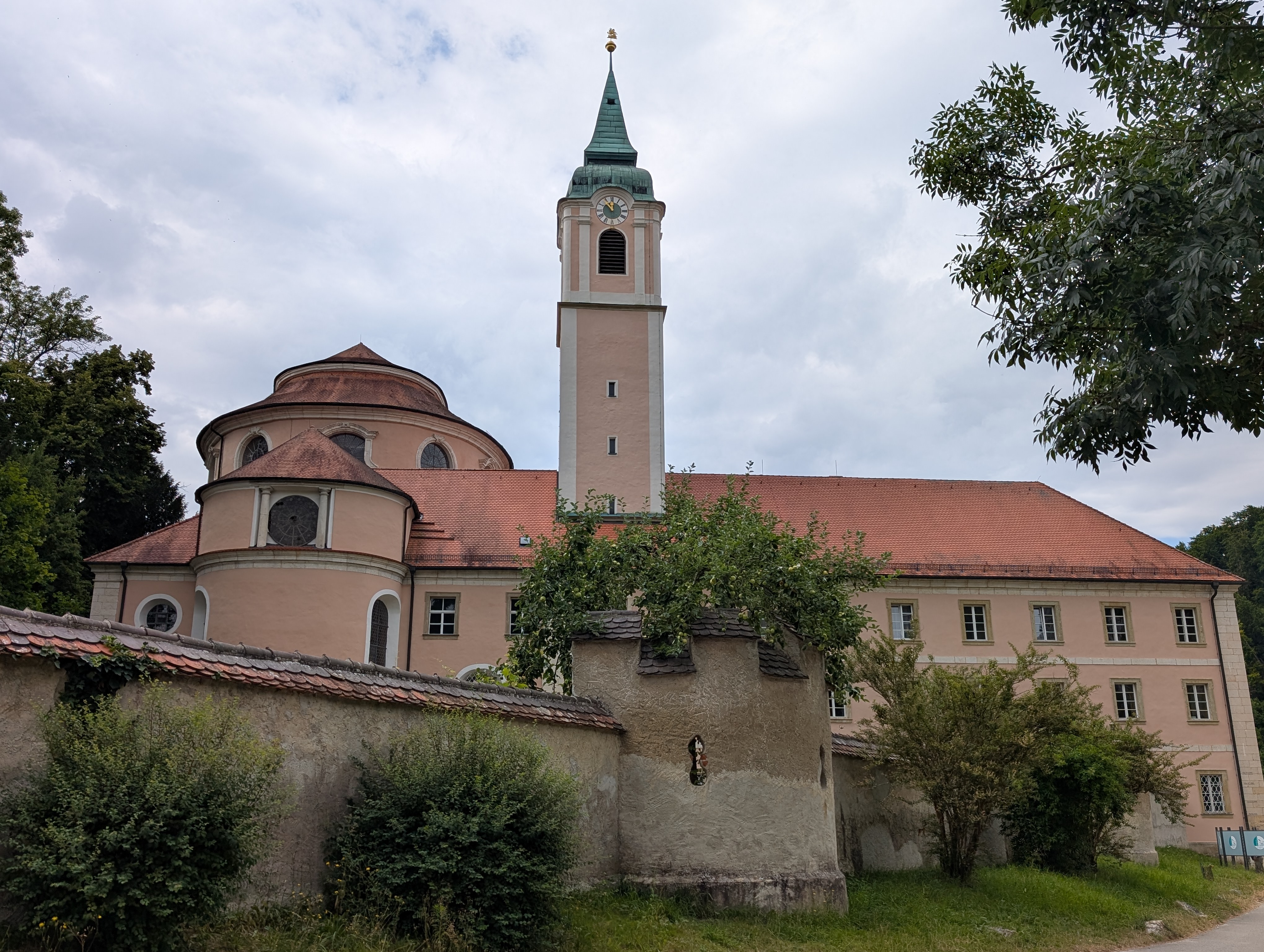
Eisenbahngeschichte „erfahren“: Schambachtalbahnradweg
Die Fahrradtour auf dem Schambachtalbahn-Radweg verläuft auf der ehemaligen Bahntrasse zwischen Ingolstadt Nord und Riedenburg, die 1904 eröffnet und 1972 im Personenverkehr stillgelegt wurde. Landschaftlicher Höhepunkt der 36 Kilometer langen Strecke ist das idyllische Schambachtal, am Wegesrand warten romantische Schlösser und wehrhafte Burganlagen. In charmanten Städtchen und historischen Ortschaften entdeckt man neben vielen Sehenswürdigkeiten und der lokalen Eisenbahngeschichte immer ein schönes Plätzchen für erholsame Pausen.
- -:--
- Duration
- 44.3 km
- Distance
- 97 m
- Ascent
- 108 m
- Descent
- ---
- Avg. speed
- ---
- Max. altitude
Route quality
Waytypes & surfaces along the route
Waytypes
Path
28.8 km
(65 %)
Cycleway
7.5 km
(17 %)
Surfaces
Paved
33.6 km
(76 %)
Unpaved
9.3 km
(21 %)
Asphalt
33.2 km
(75 %)
Gravel
8.9 km
(20 %)
Continue with Bikemap
Use, edit, or download this cycling route
You would like to ride Schambachtalbahn-Radweg or customize it for your own trip? Here is what you can do with this Bikemap route:
Free features
- Save this route as favorite or in collections
- Copy & plan your own version of this route
- Sync your route with Garmin or Wahoo
Premium features
Free trial for 3 days, or one-time payment. More about Bikemap Premium.
- Navigate this route on iOS & Android
- Export a GPX / KML file of this route
- Create your custom printout (try it for free)
- Download this route for offline navigation
Discover more Premium features.
Get Bikemap PremiumFrom our community
Other popular routes starting in Ingolstadt
 E7. 11.7.25 Ingolstadt nach Karpfenberg
- Distance
- 71.9 km
- Ascent
- 329 m
- Descent
- 401 m
- Location
- Ingolstadt, Bavaria, Germany
 Christoph-von-Schmid-Straße to Christoph-von-Schmid-Straße 21/3
- Distance
- 23.1 km
- Ascent
- 95 m
- Descent
- 141 m
- Location
- Ingolstadt, Bavaria, Germany
 Donaumoos GUS 46
- Distance
- 45.9 km
- Ascent
- 62 m
- Descent
- 65 m
- Location
- Ingolstadt, Bavaria, Germany
 Ingolstadt-Hofstetten
- Distance
- 63.1 km
- Ascent
- 379 m
- Descent
- 378 m
- Location
- Ingolstadt, Bavaria, Germany
 Ingolstadt - Bad Abbach
- Distance
- 92.7 km
- Ascent
- 560 m
- Descent
- 586 m
- Location
- Ingolstadt, Bavaria, Germany
 Radltour IN - RID - KEH - ABG - VOH - IN
- Distance
- 109 km
- Ascent
- 165 m
- Descent
- 169 m
- Location
- Ingolstadt, Bavaria, Germany
 Haag nach Ingolstadt
- Distance
- 62.3 km
- Ascent
- 437 m
- Descent
- 381 m
- Location
- Ingolstadt, Bavaria, Germany
 Denkendorf - Oberreichenbach
- Distance
- 136.3 km
- Ascent
- 977 m
- Descent
- 1,077 m
- Location
- Ingolstadt, Bavaria, Germany
Open it in the app