

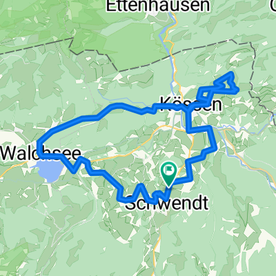
Kaiserbachtal - Kufstein - Brannenburg - Rosenheim
A cycling route starting in Schwendt, Tyrol, Austria.
Overview
About this route
Kaiserbachtal - Kufstein - Brannenburg - Rosenheim
- -:--
- Duration
- 88.4 km
- Distance
- 410 m
- Ascent
- 950 m
- Descent
- ---
- Avg. speed
- ---
- Max. altitude

Route quality
Waytypes & surfaces along the route
Waytypes
Quiet road
27.3 km
(31 %)
Busy road
25.9 km
(29 %)
Surfaces
Paved
70.3 km
(80 %)
Unpaved
9.2 km
(10 %)
Asphalt
69.9 km
(79 %)
Loose gravel
4 km
(4 %)
Continue with Bikemap
Use, edit, or download this cycling route
You would like to ride Kaiserbachtal - Kufstein - Brannenburg - Rosenheim or customize it for your own trip? Here is what you can do with this Bikemap route:
Free features
- Save this route as favorite or in collections
- Copy & plan your own version of this route
- Split it into stages to create a multi-day tour
- Sync your route with Garmin or Wahoo
Premium features
Free trial for 3 days, or one-time payment. More about Bikemap Premium.
- Navigate this route on iOS & Android
- Export a GPX / KML file of this route
- Create your custom printout (try it for free)
- Download this route for offline navigation
Discover more Premium features.
Get Bikemap PremiumFrom our community
Other popular routes starting in Schwendt
 Rund um den Unterberg
- Distance
- 32.5 km
- Ascent
- 339 m
- Descent
- 339 m
- Location
- Schwendt, Tyrol, Austria
 Schwendt Kallham 2014
- Distance
- 180.9 km
- Ascent
- 1,026 m
- Descent
- 1,305 m
- Location
- Schwendt, Tyrol, Austria
 Bichlach 16, Kössen nach Bichlach 16, Kössen
- Distance
- 37.8 km
- Ascent
- 405 m
- Descent
- 399 m
- Location
- Schwendt, Tyrol, Austria
 Kaiserwinkelrunde
- Distance
- 30.8 km
- Ascent
- 847 m
- Descent
- 844 m
- Location
- Schwendt, Tyrol, Austria
 Kaiserwinkelrunde CLONED FROM ROUTE 584447
- Distance
- 30.8 km
- Ascent
- 797 m
- Descent
- 797 m
- Location
- Schwendt, Tyrol, Austria
 schwendt-bichlach-koessen
- Distance
- 17.7 km
- Ascent
- 234 m
- Descent
- 234 m
- Location
- Schwendt, Tyrol, Austria
 Kaiserbachtal - Kufstein - Brannenburg - Rosenheim
- Distance
- 88.4 km
- Ascent
- 410 m
- Descent
- 950 m
- Location
- Schwendt, Tyrol, Austria
 Tirol megaronde
- Distance
- 192.4 km
- Ascent
- 3,816 m
- Descent
- 3,825 m
- Location
- Schwendt, Tyrol, Austria
Open it in the app