

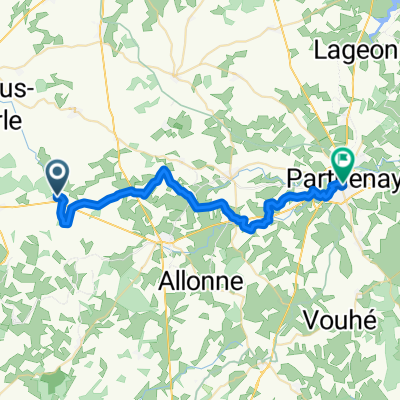
2016_E12_Segondigny-DLF
A cycling route starting in Secondigny, Nouvelle-Aquitaine, France.
Overview
About this route
10 juillet 2016
89,66Km
- -:--
- Duration
- 89.7 km
- Distance
- 280 m
- Ascent
- 378 m
- Descent
- ---
- Avg. speed
- ---
- Max. altitude

Route quality
Waytypes & surfaces along the route
Waytypes
Road
36.8 km
(41 %)
Cycleway
28.7 km
(32 %)
Surfaces
Paved
10.8 km
(12 %)
Unpaved
27.8 km
(31 %)
Pebblestone
20.6 km
(23 %)
Asphalt
10.8 km
(12 %)
Continue with Bikemap
Use, edit, or download this cycling route
You would like to ride 2016_E12_Segondigny-DLF or customize it for your own trip? Here is what you can do with this Bikemap route:
Free features
- Save this route as favorite or in collections
- Copy & plan your own version of this route
- Split it into stages to create a multi-day tour
- Sync your route with Garmin or Wahoo
Premium features
Free trial for 3 days, or one-time payment. More about Bikemap Premium.
- Navigate this route on iOS & Android
- Export a GPX / KML file of this route
- Create your custom printout (try it for free)
- Download this route for offline navigation
Discover more Premium features.
Get Bikemap PremiumFrom our community
Other popular routes starting in Secondigny
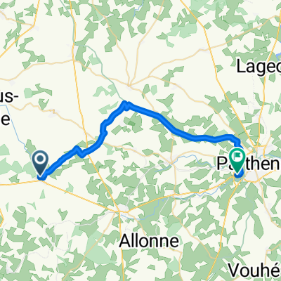
 Unnamed Road, Saint-Aubin-le-Cloud to Rue de la Citadelle 2, Parthenay
- Distance
- 14.6 km
- Ascent
- 124 m
- Descent
- 166 m
- Location
- Secondigny, Nouvelle-Aquitaine, France
 De D128 1, Beugnon-Thireuil à Rue de la Mélusine 1, Secondigny
- Distance
- 9.8 km
- Ascent
- 92 m
- Descent
- 113 m
- Location
- Secondigny, Nouvelle-Aquitaine, France
 2016_E12_Segondigny-DLF
- Distance
- 89.7 km
- Ascent
- 280 m
- Descent
- 378 m
- Location
- Secondigny, Nouvelle-Aquitaine, France
 BP etapa6 suave
- Distance
- 32.5 km
- Ascent
- 247 m
- Descent
- 257 m
- Location
- Secondigny, Nouvelle-Aquitaine, France
 BP etapa6 suave
- Distance
- 32.5 km
- Ascent
- 247 m
- Descent
- 257 m
- Location
- Secondigny, Nouvelle-Aquitaine, France
 Day 7 Outline
- Distance
- 111.9 km
- Ascent
- 156 m
- Descent
- 347 m
- Location
- Secondigny, Nouvelle-Aquitaine, France
 Recovered Route
- Distance
- 11.2 km
- Ascent
- 108 m
- Descent
- 97 m
- Location
- Secondigny, Nouvelle-Aquitaine, France
 BP ETAPA 6 FINAL
- Distance
- 29.2 km
- Ascent
- 132 m
- Descent
- 166 m
- Location
- Secondigny, Nouvelle-Aquitaine, France
Open it in the app