

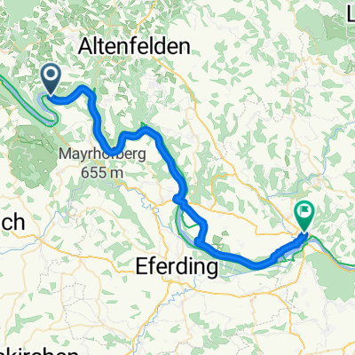
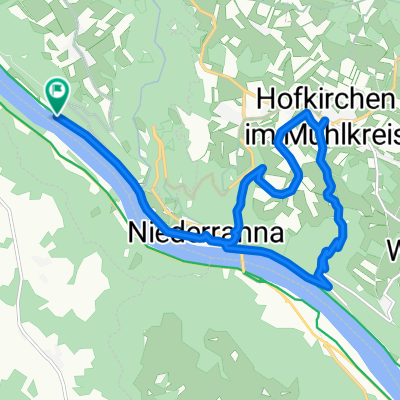
Lange Ausfahrt von Hofkirchen im Mühlkreis nach Aschach an der Donau
A cycling route starting in Pfarrkirchen im Mühlkreis, Upper Austria, Austria.
Overview
About this route
- -:--
- Duration
- 33.1 km
- Distance
- 310 m
- Ascent
- 329 m
- Descent
- ---
- Avg. speed
- ---
- Max. altitude
Route quality
Waytypes & surfaces along the route
Waytypes
Quiet road
30.4 km
(92 %)
Track
1.3 km
(4 %)
Surfaces
Paved
31.4 km
(95 %)
Unpaved
1 km
(3 %)
Asphalt
31.4 km
(95 %)
Ground
1 km
(3 %)
Undefined
0.7 km
(2 %)
Route highlights
Points of interest along the route

Point of interest after 22.6 km
10 km vor Aschach

Point of interest after 23.3 km
Rohrkolben an der Donau
Continue with Bikemap
Use, edit, or download this cycling route
You would like to ride Lange Ausfahrt von Hofkirchen im Mühlkreis nach Aschach an der Donau or customize it for your own trip? Here is what you can do with this Bikemap route:
Free features
- Save this route as favorite or in collections
- Copy & plan your own version of this route
- Sync your route with Garmin or Wahoo
Premium features
Free trial for 3 days, or one-time payment. More about Bikemap Premium.
- Navigate this route on iOS & Android
- Export a GPX / KML file of this route
- Create your custom printout (try it for free)
- Download this route for offline navigation
Discover more Premium features.
Get Bikemap PremiumFrom our community
Other popular routes starting in Pfarrkirchen im Mühlkreis
 Inzell nach Ottensheim
- Distance
- 40.1 km
- Ascent
- 636 m
- Descent
- 665 m
- Location
- Pfarrkirchen im Mühlkreis, Upper Austria, Austria
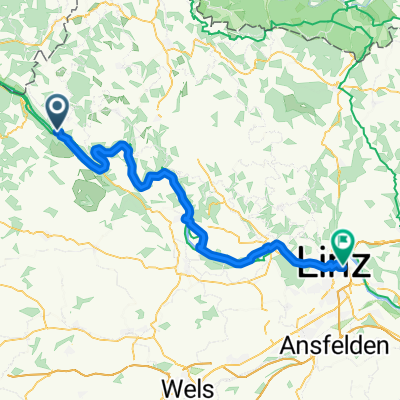
 Pfarrkirchen im Mühlkreis - Linz
- Distance
- 79.3 km
- Ascent
- 27 m
- Descent
- 86 m
- Location
- Pfarrkirchen im Mühlkreis, Upper Austria, Austria
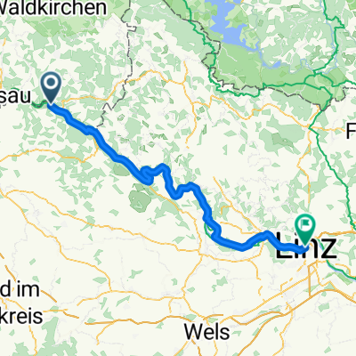
 Von Hofkirchen im Mühlkreis bis Linz
- Distance
- 65.5 km
- Ascent
- 953 m
- Descent
- 972 m
- Location
- Pfarrkirchen im Mühlkreis, Upper Austria, Austria
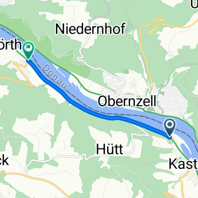
 Obernzell Donau-Inn Rundtour
- Distance
- 54.7 km
- Ascent
- 560 m
- Descent
- 561 m
- Location
- Pfarrkirchen im Mühlkreis, Upper Austria, Austria
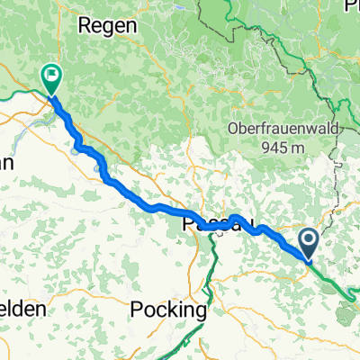 Pfarrkirchen - Vilshofen an der Donau
- Distance
- 83.8 km
- Ascent
- 448 m
- Descent
- 423 m
- Location
- Pfarrkirchen im Mühlkreis, Upper Austria, Austria
 Route zu Gasthof Luger
- Distance
- 15.2 km
- Ascent
- 413 m
- Descent
- 416 m
- Location
- Pfarrkirchen im Mühlkreis, Upper Austria, Austria
 Deggendorf - Pfarrkirchen im Mühlkreis
- Distance
- 3.5 km
- Ascent
- 39 m
- Descent
- 68 m
- Location
- Pfarrkirchen im Mühlkreis, Upper Austria, Austria
 Pfarrkirchen im Mühlkreis - Feldkirchen an der Donau
- Distance
- 24.5 km
- Ascent
- 650 m
- Descent
- 644 m
- Location
- Pfarrkirchen im Mühlkreis, Upper Austria, Austria
Open it in the app