
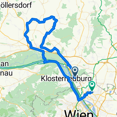
Dopplerhütte
A cycling route starting in Langenzersdorf, Lower Austria, Austria.
Overview
About this route
- -:--
- Duration
- 52 km
- Distance
- 612 m
- Ascent
- 473 m
- Descent
- ---
- Avg. speed
- 304 m
- Max. altitude
Route quality
Waytypes & surfaces along the route
Waytypes
Quiet road
5.2 km
(10 %)
Cycleway
4.7 km
(9 %)
Surfaces
Paved
49.4 km
(95 %)
Asphalt
48.8 km
(94 %)
Concrete
0.5 km
(1 %)
Undefined
2.6 km
(5 %)
Continue with Bikemap
Use, edit, or download this cycling route
You would like to ride Dopplerhütte or customize it for your own trip? Here is what you can do with this Bikemap route:
Free features
- Save this route as favorite or in collections
- Copy & plan your own version of this route
- Sync your route with Garmin or Wahoo
Premium features
Free trial for 3 days, or one-time payment. More about Bikemap Premium.
- Navigate this route on iOS & Android
- Export a GPX / KML file of this route
- Create your custom printout (try it for free)
- Download this route for offline navigation
Discover more Premium features.
Get Bikemap PremiumFrom our community
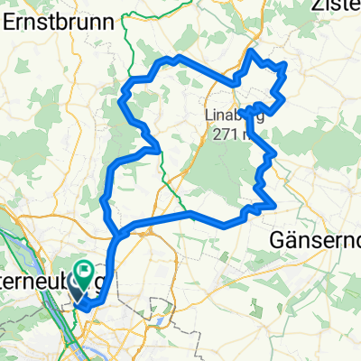
Other popular routes starting in Langenzersdorf
 Kloburgrunde, ca.700 hm
- Distance
- 53.9 km
- Ascent
- 705 m
- Descent
- 705 m
- Location
- Langenzersdorf, Lower Austria, Austria
 Rußbergstraße nach Rußbergstraße
- Distance
- 14.6 km
- Ascent
- 279 m
- Descent
- 325 m
- Location
- Langenzersdorf, Lower Austria, Austria
 Krapfenwaldgasse 65-73 nach Michaelerwaldweg
- Distance
- 8.4 km
- Ascent
- 191 m
- Descent
- 241 m
- Location
- Langenzersdorf, Lower Austria, Austria
 Dopplerhütte
- Distance
- 52 km
- Ascent
- 612 m
- Descent
- 473 m
- Location
- Langenzersdorf, Lower Austria, Austria
 2025-07-22_Wien - Hainburg
- Distance
- 74.8 km
- Ascent
- 354 m
- Descent
- 360 m
- Location
- Langenzersdorf, Lower Austria, Austria
 Sierndorf - Streitdorf ....
- Distance
- 76.5 km
- Ascent
- 358 m
- Descent
- 364 m
- Location
- Langenzersdorf, Lower Austria, Austria
 Route in Wien
- Distance
- 109.6 km
- Ascent
- 877 m
- Descent
- 878 m
- Location
- Langenzersdorf, Lower Austria, Austria
 Urban Nature afterwork
- Distance
- 26.2 km
- Ascent
- 173 m
- Descent
- 219 m
- Location
- Langenzersdorf, Lower Austria, Austria
Open it in the app