

Girolibero: Ciclabile della Drava classica
A cycling route starting in Innichen, Trentino-Alto Adige, Italy.
Overview
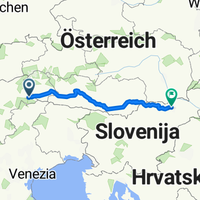
About this route
Accommodations: Sillian, Lienz, Berg im Drautal/Dellach, Sachsenburg/Spittal, Villach, Klagenfurt
Route: flat route: half on a paved cycle path, the rest on rural lanes or lightly trafficked back roads.- -:--
- Duration
- 293.4 km
- Distance
- 772 m
- Ascent
- 1,526 m
- Descent
- ---
- Avg. speed
- ---
- Max. altitude

Route highlights
Points of interest along the route
Accommodation after 11.5 km
Sillian
Accommodation after 42.2 km
Lienz
Point of interest after 72.7 km
Dellach
Accommodation after 77.5 km
Berg im Drautal
Point of interest after 99.3 km
Sachsenburg
Accommodation after 112.1 km
Spittal
Accommodation after 147.2 km
Villach
Point of interest after 177.1 km
Ossiacher See
Point of interest after 279.4 km
Wörthersee
Accommodation after 293.4 km
Klagenfurt
Continue with Bikemap
Use, edit, or download this cycling route
You would like to ride Girolibero: Ciclabile della Drava classica or customize it for your own trip? Here is what you can do with this Bikemap route:
Free features
- Save this route as favorite or in collections
- Copy & plan your own version of this route
- Split it into stages to create a multi-day tour
- Sync your route with Garmin or Wahoo
Premium features
Free trial for 3 days, or one-time payment. More about Bikemap Premium.
- Navigate this route on iOS & Android
- Export a GPX / KML file of this route
- Create your custom printout (try it for free)
- Download this route for offline navigation
Discover more Premium features.
Get Bikemap PremiumFrom our community
Other popular routes starting in Innichen
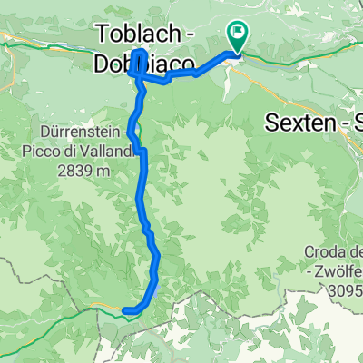
 1_Drau_Innichen_Lienz
- Distance
- 44.2 km
- Ascent
- 428 m
- Descent
- 925 m
- Location
- Innichen, Trentino-Alto Adige, Italy
 Girolibero: Ciclabile della Drava classica
- Distance
- 293.4 km
- Ascent
- 772 m
- Descent
- 1,526 m
- Location
- Innichen, Trentino-Alto Adige, Italy
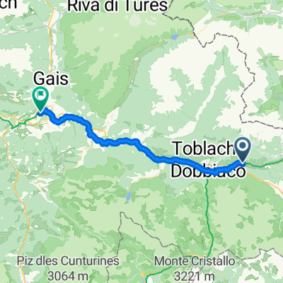
 Sankt-Michaels-Platz, Innichen nach Berg, Berg im Drautal
- Distance
- 79.2 km
- Ascent
- 767 m
- Descent
- 1,262 m
- Location
- Innichen, Trentino-Alto Adige, Italy
 Drauradweg: Toblach - Maribor
- Distance
- 358.8 km
- Ascent
- 358 m
- Descent
- 1,495 m
- Location
- Innichen, Trentino-Alto Adige, Italy
 Route to Parcheggio Via Michael Hyronimus Hueber
- Distance
- 46.4 km
- Ascent
- 663 m
- Descent
- 663 m
- Location
- Innichen, Trentino-Alto Adige, Italy
 Recording from 9 Gennaio 12:53 PM
- Distance
- 7.7 km
- Ascent
- 219 m
- Descent
- 271 m
- Location
- Innichen, Trentino-Alto Adige, Italy
 Drava
Drava- Distance
- 348.1 km
- Ascent
- 494 m
- Descent
- 1,413 m
- Location
- Innichen, Trentino-Alto Adige, Italy
 Trentino -- San Candido - Brunico
- Distance
- 35.4 km
- Ascent
- 119 m
- Descent
- 464 m
- Location
- Innichen, Trentino-Alto Adige, Italy
Open it in the app