

RT 2016, 5. Etappe; TBB - Miltenberg
A cycling route starting in Tauberbischofsheim, Baden-Wurttemberg, Germany.
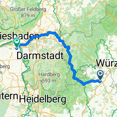
Overview
About this route
From TBB uphill via Königsheim to Hardheim, and from there downhill through the Erft valley to Miltenberg.
The stage was planned shorter to allow more time for the very beautiful Miltenberg.
Overnight stay at the very good Brauerei Keller hotel right in the center of Miltenberg.
Preparations for the summer festival were also in full swing in Miltenberg.
- -:--
- Duration
- 46 km
- Distance
- 358 m
- Ascent
- 416 m
- Descent
- ---
- Avg. speed
- ---
- Max. altitude

Route quality
Waytypes & surfaces along the route
Waytypes
Track
19.3 km
(42 %)
Quiet road
10.1 km
(22 %)
Surfaces
Paved
44.2 km
(96 %)
Unpaved
0.5 km
(1 %)
Asphalt
38.2 km
(83 %)
Paved (undefined)
6 km
(13 %)
Continue with Bikemap
Use, edit, or download this cycling route
You would like to ride RT 2016, 5. Etappe; TBB - Miltenberg or customize it for your own trip? Here is what you can do with this Bikemap route:
Free features
- Save this route as favorite or in collections
- Copy & plan your own version of this route
- Sync your route with Garmin or Wahoo
Premium features
Free trial for 3 days, or one-time payment. More about Bikemap Premium.
- Navigate this route on iOS & Android
- Export a GPX / KML file of this route
- Create your custom printout (try it for free)
- Download this route for offline navigation
Discover more Premium features.
Get Bikemap PremiumFrom our community
Other popular routes starting in Tauberbischofsheim
 Bierliebhaber Rundkurs
- Distance
- 29.5 km
- Ascent
- 581 m
- Descent
- 532 m
- Location
- Tauberbischofsheim, Baden-Wurttemberg, Germany
 RT 2016, 5. Etappe; TBB - Miltenberg
- Distance
- 46 km
- Ascent
- 358 m
- Descent
- 416 m
- Location
- Tauberbischofsheim, Baden-Wurttemberg, Germany
 Tauber Main
- Distance
- 110.4 km
- Ascent
- 642 m
- Descent
- 644 m
- Location
- Tauberbischofsheim, Baden-Wurttemberg, Germany
 Lange Ausfahrt durch Taubertal
- Distance
- 40.1 km
- Ascent
- 118 m
- Descent
- 118 m
- Location
- Tauberbischofsheim, Baden-Wurttemberg, Germany
 Mountainbikerunde TBB-Grünsfeld-Lauda
- Distance
- 38.9 km
- Ascent
- 671 m
- Descent
- 673 m
- Location
- Tauberbischofsheim, Baden-Wurttemberg, Germany
 Von Tauberbischofsheim bis Mainz
- Distance
- 181.5 km
- Ascent
- 1,119 m
- Descent
- 1,163 m
- Location
- Tauberbischofsheim, Baden-Wurttemberg, Germany
 UT 08-2023: Tauberbischofsheim - Miltenberg
- Distance
- 62.8 km
- Ascent
- 427 m
- Descent
- 476 m
- Location
- Tauberbischofsheim, Baden-Wurttemberg, Germany
 Tauber-Welzbach-Grünbach-Tauber
- Distance
- 49.6 km
- Ascent
- 260 m
- Descent
- 258 m
- Location
- Tauberbischofsheim, Baden-Wurttemberg, Germany
Open it in the app