SALIDA 10 - 7 ABRIL 2019
- 78.6 km
- 732 m
- 738 m
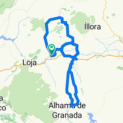
- Huétor-Tájar, Andalusia, Spain
A cycling route starting in Huétor-Tájar, Andalusia, Spain.
Overview
HUÉTOR TAJAR - LA CATALANA - SERVICE ROAD - LA MORALEDA CROSSING - MORALEDA DE ZAFAYONA - BUENAVISTA - ALHAMA DE GRANADA - SALAR - SERVICE ROAD A92 - LOJA - LA ESPERANZA - HUÉTOR TAJAR
created this 9 years ago
Route quality
Road
38.8 km
(50 %)
Track
9.3 km
(12 %)
Paved
62.8 km
(81 %)
Asphalt
58.9 km
(76 %)
Paved (undefined)
3.9 km
(5 %)
Undefined
14.7 km
(19 %)
Continue with Bikemap
You would like to ride XXI MARCHA CICLOTURISTA DE HUETOR TAJAR - RECORRIDO CORTO(oficial) or customize it for your own trip? Here is what you can do with this Bikemap route:
Free trial for 3 days, or one-time payment. More about Bikemap Premium.
Discover more Premium features.
Get Bikemap PremiumFrom our community
Open it in the app