

RT 2016, 2. Etappe; Pappenheim - Ansbach
A cycling route starting in Pappenheim, Bavaria, Germany.
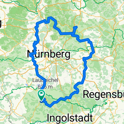
Overview
About this route
From Pappenheim upstream along the Altmühl valley to Gunzenhausen. The well-marked cycle path from Treuchtlingen follows a rather monotonous route along the railway line through the fields.
Gunzenhausen and the Altmühlsee are worth seeing and a longer break.
Continue along the Altmühl to Ornbau and there take the cycle path along the B13 to Ansbach. It would have been better to ride through the small villages west of the B13.
Overnight stay at Hotel Grüner Baum, close to the town centre but already somewhat run-down.
Ansbach is definitely worth a visit.
- -:--
- Duration
- 67.9 km
- Distance
- 154 m
- Ascent
- 158 m
- Descent
- ---
- Avg. speed
- ---
- Max. altitude

Route quality
Waytypes & surfaces along the route
Waytypes
Track
27.8 km
(41 %)
Path
16.3 km
(24 %)
Surfaces
Paved
48.9 km
(72 %)
Unpaved
7.5 km
(11 %)
Asphalt
43.5 km
(64 %)
Gravel
4.8 km
(7 %)
Continue with Bikemap
Use, edit, or download this cycling route
You would like to ride RT 2016, 2. Etappe; Pappenheim - Ansbach or customize it for your own trip? Here is what you can do with this Bikemap route:
Free features
- Save this route as favorite or in collections
- Copy & plan your own version of this route
- Sync your route with Garmin or Wahoo
Premium features
Free trial for 3 days, or one-time payment. More about Bikemap Premium.
- Navigate this route on iOS & Android
- Export a GPX / KML file of this route
- Create your custom printout (try it for free)
- Download this route for offline navigation
Discover more Premium features.
Get Bikemap PremiumFrom our community
Other popular routes starting in Pappenheim
 Osterdorf 400
- Distance
- 416.5 km
- Ascent
- 1,334 m
- Descent
- 1,334 m
- Location
- Pappenheim, Bavaria, Germany
 Altmuhl2
- Distance
- 37.2 km
- Ascent
- 160 m
- Descent
- 181 m
- Location
- Pappenheim, Bavaria, Germany
 Bayerrundfahrt 1200er
- Distance
- 276.4 km
- Ascent
- 1,155 m
- Descent
- 873 m
- Location
- Pappenheim, Bavaria, Germany
 HE04-Pappenheim-Beilngries
- Distance
- 71.6 km
- Ascent
- 250 m
- Descent
- 290 m
- Location
- Pappenheim, Bavaria, Germany
 2012-04-21 300er Brevet Osterdorf
- Distance
- 319 km
- Ascent
- 978 m
- Descent
- 978 m
- Location
- Pappenheim, Bavaria, Germany
 6PaheimHerrieden
- Distance
- 64.3 km
- Ascent
- 119 m
- Descent
- 109 m
- Location
- Pappenheim, Bavaria, Germany
 Altmühltal 200km Brevet
- Distance
- 210.1 km
- Ascent
- 2,484 m
- Descent
- 2,477 m
- Location
- Pappenheim, Bavaria, Germany
 20140412 Samstag / Brevet 300km Osterdorf
- Distance
- 340.6 km
- Ascent
- 748 m
- Descent
- 746 m
- Location
- Pappenheim, Bavaria, Germany
Open it in the app